You are here: Home > Network List > US - United States National Seismic Network Stations List
> Station HAWA Hanford, Washington, USA > Earthquake Result Viewer
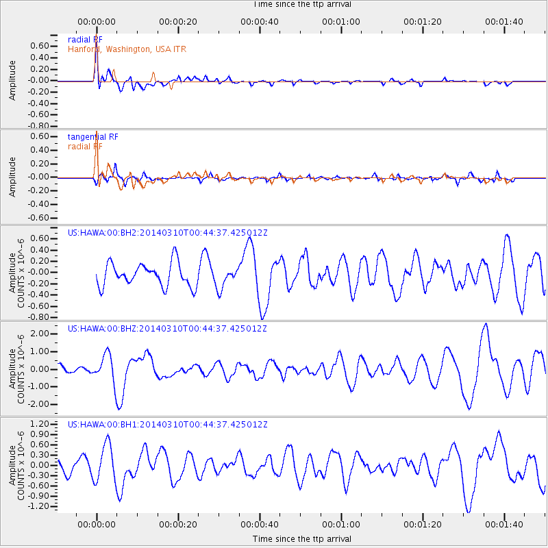
HAWA Hanford, Washington, USA - Earthquake Result Viewer
*The percent match for this event was below the threshold and hence no stack was calculated.
| Earthquake location: |
Near Coast Of Guerrero, Mexico |
| Earthquake latitude/longitude: |
16.0/-98.3 |
| Earthquake time(UTC): |
2014/03/10 (069) 00:38:15 GMT |
| Earthquake Depth: |
8.4 km |
| Earthquake Magnitude: |
5.8 MWW, 5.9 MWC, 6.0 MWB |
| Earthquake Catalog/Contributor: |
NEIC PDE/NEIC COMCAT |
|
| Network: |
US United States National Seismic Network |
| Station: |
HAWA Hanford, Washington, USA |
| Lat/Lon: |
46.39 N/119.53 W |
| Elevation: |
364 m |
|
| Distance: |
35.0 deg |
| Az: |
334.161 deg |
| Baz: |
142.736 deg |
| Ray Param: |
$rayparam |
*The percent match for this event was below the threshold and hence was not used in the summary stack. |
|
| Radial Match: |
67.40684 % |
| Radial Bump: |
400 |
| Transverse Match: |
57.699905 % |
| Transverse Bump: |
400 |
| SOD ConfigId: |
626651 |
| Insert Time: |
2014-04-21 02:53:57.034 +0000 |
| GWidth: |
2.5 |
| Max Bumps: |
400 |
| Tol: |
0.001 |
|
Signal To Noise
| Channel | StoN | STA | LTA |
| US:HAWA:00:BHZ:20140310T00:44:37.425012Z | 3.0465875 | 8.160188E-7 | 2.6784684E-7 |
| US:HAWA:00:BH1:20140310T00:44:37.425012Z | 3.3783917 | 5.558155E-7 | 1.6452076E-7 |
| US:HAWA:00:BH2:20140310T00:44:37.425012Z | 0.9152813 | 1.8598963E-7 | 2.0320488E-7 |
| Arrivals |
| Ps | |
| PpPs | |
| PsPs/PpSs | |


