FRB IQALUIT, N.W.T. - Earthquake Result Viewer
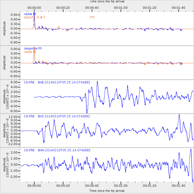
Earthquake location: Off Coast Of Northern California
Earthquake latitude/longitude: 40.8/-125.1
Earthquake time(UTC): 2014/03/10 (069) 05:18:13 GMT
Earthquake Depth: 17 km
Earthquake Magnitude: 6.8 MW, 6.8 MWR, 6.9 MWW, 6.9 MWB, 7.0 MI, 7.0 MWC
Earthquake Catalog/Contributor: NEIC PDE/NEIC COMCAT
Network: CN Canadian National Seismograph Network
Station: FRB IQALUIT, N.W.T.
Lat/Lon: 63.75 N/68.55 W
Elevation: 18 m
Distance: 39.7 deg
Az: 35.515 deg
Baz: 262.391 deg
Ray Param: 0.07480406
Estimated Moho Depth: 42.25 km
Estimated Crust Vp/Vs: 1.83
Assumed Crust Vp: 6.419 km/s
Estimated Crust Vs: 3.503 km/s
Estimated Crust Poisson's Ratio: 0.29
Radial Match: 94.20478 %
Radial Bump: 206
Transverse Match: 77.234535 %
Transverse Bump: 400
SOD ConfigId: 626651
Insert Time: 2014-04-21 02:58:34.313 +0000
GWidth: 2.5
Max Bumps: 400
Tol: 0.001

Signal To Noise

ChannelStoNSTALTA
CN:FRB: :BHZ:20140310T05:25:14.074988Z7.01520541.2027361E-61.7144704E-7
CN:FRB: :BHN:20140310T05:25:14.074988Z1.2090621.184112E-79.793642E-8
CN:FRB: :BHE:20140310T05:25:14.074988Z4.55090576.779594E-71.4897242E-7
Arrivals
Ps5.9 SECOND
PpPs17 SECOND
PsPs/PpSs23 SECOND