FDF Fort de France, Martinique France - Earthquake Result Viewer
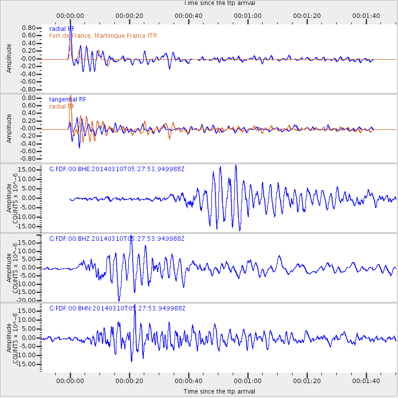
Earthquake location: Off Coast Of Northern California
Earthquake latitude/longitude: 40.8/-125.1
Earthquake time(UTC): 2014/03/10 (069) 05:18:13 GMT
Earthquake Depth: 17 km
Earthquake Magnitude: 6.8 MW, 6.8 MWR, 6.9 MWW, 6.9 MWB, 7.0 MI, 7.0 MWC
Earthquake Catalog/Contributor: NEIC PDE/NEIC COMCAT
Network: G GEOSCOPE
Station: FDF Fort de France, Martinique France
Lat/Lon: 14.73 N/61.14 W
Elevation: 467 m
Distance: 60.9 deg
Az: 95.552 deg
Baz: 308.682 deg
Ray Param: 0.061222233
Estimated Moho Depth: 18.25 km
Estimated Crust Vp/Vs: 2.05
Assumed Crust Vp: 5.88 km/s
Estimated Crust Vs: 2.872 km/s
Estimated Crust Poisson's Ratio: 0.34
Radial Match: 92.344955 %
Radial Bump: 400
Transverse Match: 89.39155 %
Transverse Bump: 400
SOD ConfigId: 626651
Insert Time: 2014-04-21 03:00:25.396 +0000
GWidth: 2.5
Max Bumps: 400
Tol: 0.001

Signal To Noise

ChannelStoNSTALTA
G:FDF:00:BHZ:20140310T05:27:53.949988Z6.72211651.914622E-62.8482432E-7
G:FDF:00:BHN:20140310T05:27:53.949988Z1.67506849.425567E-75.6269744E-7
G:FDF:00:BHE:20140310T05:27:53.949988Z2.43631981.0563049E-64.3356573E-7
Arrivals
Ps3.4 SECOND
PpPs9.2 SECOND
PsPs/PpSs13 SECOND