PQI Presque Isle, ME, USA - Earthquake Result Viewer
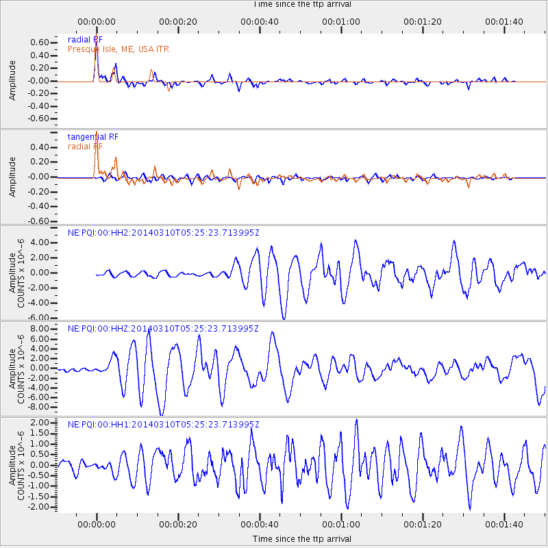
Earthquake location: Off Coast Of Northern California
Earthquake latitude/longitude: 40.8/-125.1
Earthquake time(UTC): 2014/03/10 (069) 05:18:13 GMT
Earthquake Depth: 17 km
Earthquake Magnitude: 6.8 MW, 6.8 MWR, 6.9 MWW, 6.9 MWB, 7.0 MI, 7.0 MWC
Earthquake Catalog/Contributor: NEIC PDE/NEIC COMCAT
Network: NE New England Seismic Network
Station: PQI Presque Isle, ME, USA
Lat/Lon: 46.67 N/68.02 W
Elevation: 162 m
Distance: 40.9 deg
Az: 62.057 deg
Baz: 283.222 deg
Ray Param: 0.07411611
Estimated Moho Depth: 35.0 km
Estimated Crust Vp/Vs: 1.82
Assumed Crust Vp: 6.419 km/s
Estimated Crust Vs: 3.527 km/s
Estimated Crust Poisson's Ratio: 0.28
Radial Match: 93.49435 %
Radial Bump: 285
Transverse Match: 81.44322 %
Transverse Bump: 400
SOD ConfigId: 626651
Insert Time: 2014-04-21 03:06:42.923 +0000
GWidth: 2.5
Max Bumps: 400
Tol: 0.001

Signal To Noise

ChannelStoNSTALTA
NE:PQI:00:HHZ:20140310T05:25:23.713995Z6.25041631.6286065E-62.605597E-7
NE:PQI:00:HH1:20140310T05:25:23.713995Z0.9246672.5462822E-72.7537288E-7
NE:PQI:00:HH2:20140310T05:25:23.713995Z3.0970429.0824955E-72.9326355E-7
Arrivals
Ps4.8 SECOND
PpPs14 SECOND
PsPs/PpSs19 SECOND