
WRPS We R Penn State - Earthquake Result Viewer
| ||||||||||||||||||
| ||||||||||||||||||
| ||||||||||||||||||
|
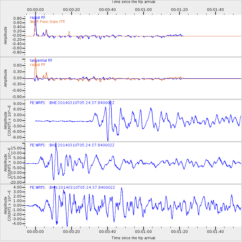
Signal To Noise
| Channel | StoN | STA | LTA |
| PE:WRPS: :BHZ:20140310T05:24:37.840002Z | 19.64431 | 3.0621034E-6 | 1.5587737E-7 |
| PE:WRPS: :BHN:20140310T05:24:37.840002Z | 5.166183 | 5.9214733E-7 | 1.14619894E-7 |
| PE:WRPS: :BHE:20140310T05:24:37.840002Z | 17.172632 | 2.0722093E-6 | 1.2066928E-7 |
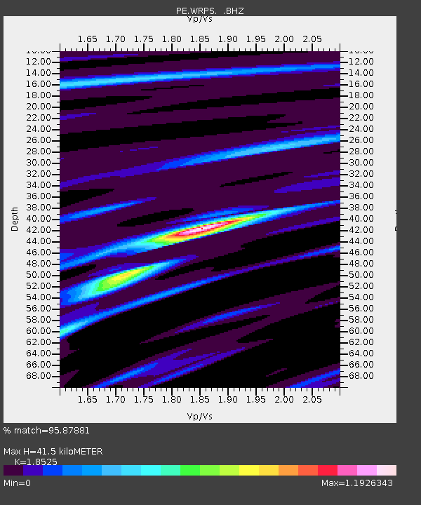
| Arrivals | |
| Ps | 6.2 SECOND |
| PpPs | 18 SECOND |
| PsPs/PpSs | 24 SECOND |

