D49A Beulah Township, ON, CAN - Earthquake Result Viewer
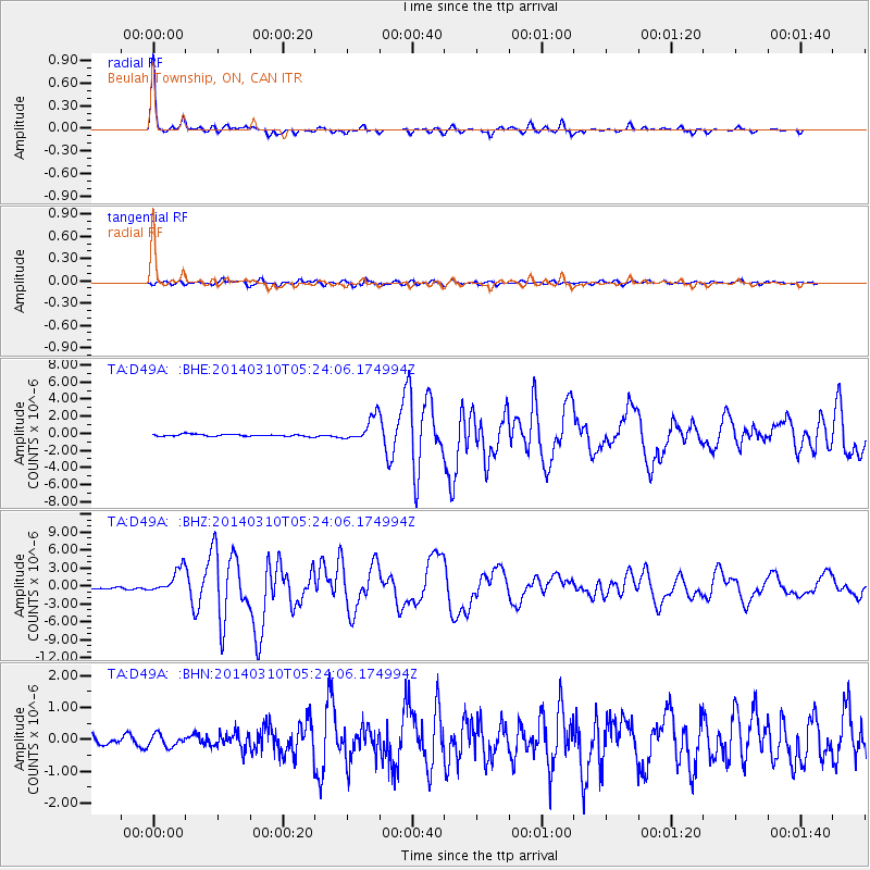
Earthquake location: Off Coast Of Northern California
Earthquake latitude/longitude: 40.8/-125.1
Earthquake time(UTC): 2014/03/10 (069) 05:18:13 GMT
Earthquake Depth: 17 km
Earthquake Magnitude: 6.8 MW, 6.8 MWR, 6.9 MWW, 6.9 MWB, 7.0 MI, 7.0 MWC
Earthquake Catalog/Contributor: NEIC PDE/NEIC COMCAT
Network: TA USArray Transportable Network (new EarthScope stations)
Station: D49A Beulah Township, ON, CAN
Lat/Lon: 47.27 N/81.36 W
Elevation: 416 m
Distance: 31.8 deg
Az: 63.443 deg
Baz: 274.603 deg
Ray Param: 0.07891713
Estimated Moho Depth: 32.75 km
Estimated Crust Vp/Vs: 1.86
Assumed Crust Vp: 6.467 km/s
Estimated Crust Vs: 3.481 km/s
Estimated Crust Poisson's Ratio: 0.30
Radial Match: 96.67297 %
Radial Bump: 235
Transverse Match: 82.22445 %
Transverse Bump: 400
SOD ConfigId: 626651
Insert Time: 2014-04-21 03:09:19.678 +0000
GWidth: 2.5
Max Bumps: 400
Tol: 0.001

Signal To Noise

ChannelStoNSTALTA
TA:D49A: :BHZ:20140310T05:24:06.174994Z14.1023262.0439672E-61.449383E-7
TA:D49A: :BHN:20140310T05:24:06.174994Z1.47770821.8995902E-71.2854976E-7
TA:D49A: :BHE:20140310T05:24:06.174994Z12.0132971.4348207E-61.1943604E-7
Arrivals
Ps4.7 SECOND
PpPs13 SECOND
PsPs/PpSs18 SECOND