E63A Oxbow, ME, USA - Earthquake Result Viewer
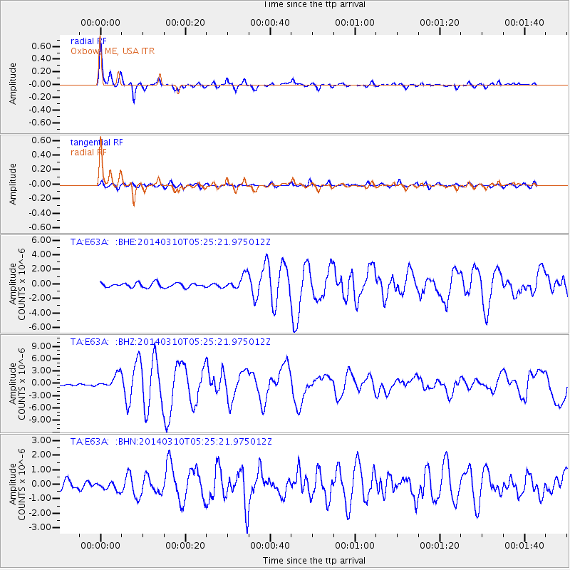
Earthquake location: Off Coast Of Northern California
Earthquake latitude/longitude: 40.8/-125.1
Earthquake time(UTC): 2014/03/10 (069) 05:18:13 GMT
Earthquake Depth: 17 km
Earthquake Magnitude: 6.8 MW, 6.8 MWR, 6.9 MWW, 6.9 MWB, 7.0 MI, 7.0 MWC
Earthquake Catalog/Contributor: NEIC PDE/NEIC COMCAT
Network: TA USArray Transportable Network (new EarthScope stations)
Station: E63A Oxbow, ME, USA
Lat/Lon: 46.42 N/68.42 W
Elevation: 238 m
Distance: 40.7 deg
Az: 62.526 deg
Baz: 283.286 deg
Ray Param: 0.07424541
Estimated Moho Depth: 32.75 km
Estimated Crust Vp/Vs: 1.88
Assumed Crust Vp: 6.419 km/s
Estimated Crust Vs: 3.414 km/s
Estimated Crust Poisson's Ratio: 0.30
Radial Match: 94.225174 %
Radial Bump: 395
Transverse Match: 77.72936 %
Transverse Bump: 400
SOD ConfigId: 626651
Insert Time: 2014-04-21 03:10:23.001 +0000
GWidth: 2.5
Max Bumps: 400
Tol: 0.001

Signal To Noise

ChannelStoNSTALTA
TA:E63A: :BHZ:20140310T05:25:21.975012Z5.03757331.7705246E-63.514638E-7
TA:E63A: :BHN:20140310T05:25:21.975012Z0.989160242.899019E-72.9307878E-7
TA:E63A: :BHE:20140310T05:25:21.975012Z3.30689721.0110609E-63.057431E-7
Arrivals
Ps4.8 SECOND
PpPs14 SECOND
PsPs/PpSs19 SECOND