E64A Bridgewater, ME, USA - Earthquake Result Viewer
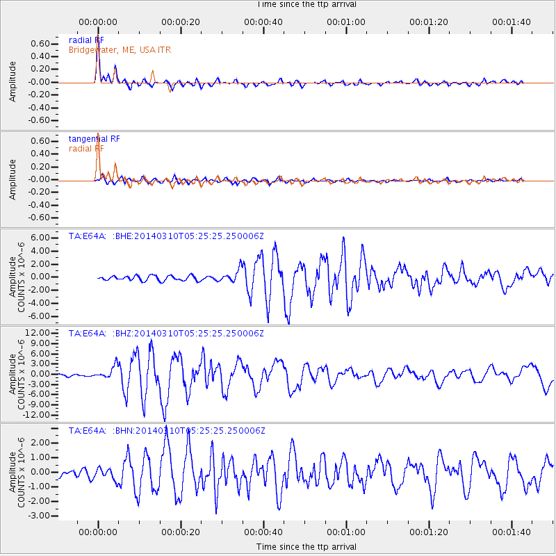
Earthquake location: Off Coast Of Northern California
Earthquake latitude/longitude: 40.8/-125.1
Earthquake time(UTC): 2014/03/10 (069) 05:18:13 GMT
Earthquake Depth: 17 km
Earthquake Magnitude: 6.8 MW, 6.8 MWR, 6.9 MWW, 6.9 MWB, 7.0 MI, 7.0 MWC
Earthquake Catalog/Contributor: NEIC PDE/NEIC COMCAT
Network: TA USArray Transportable Network (new EarthScope stations)
Station: E64A Bridgewater, ME, USA
Lat/Lon: 46.42 N/67.83 W
Elevation: 190 m
Distance: 41.1 deg
Az: 62.385 deg
Baz: 283.608 deg
Ray Param: 0.074001394
Estimated Moho Depth: 35.25 km
Estimated Crust Vp/Vs: 1.72
Assumed Crust Vp: 6.419 km/s
Estimated Crust Vs: 3.743 km/s
Estimated Crust Poisson's Ratio: 0.24
Radial Match: 94.52289 %
Radial Bump: 391
Transverse Match: 85.32338 %
Transverse Bump: 400
SOD ConfigId: 626651
Insert Time: 2014-04-21 03:10:24.035 +0000
GWidth: 2.5
Max Bumps: 400
Tol: 0.001

Signal To Noise

ChannelStoNSTALTA
TA:E64A: :BHZ:20140310T05:25:25.250006Z6.8790021.9359043E-62.8142225E-7
TA:E64A: :BHN:20140310T05:25:25.250006Z2.16228183.9577614E-71.8303633E-7
TA:E64A: :BHE:20140310T05:25:25.250006Z2.77907731.0114472E-63.6395073E-7
Arrivals
Ps4.2 SECOND
PpPs14 SECOND
PsPs/PpSs18 SECOND