You are here: Home > Network List > TA - USArray Transportable Network (new EarthScope stations) Stations List
> Station 121A Cookes Peak, Deming, NM, USA > Earthquake Result Viewer
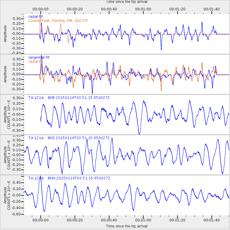
121A Cookes Peak, Deming, NM, USA - Earthquake Result Viewer
*The percent match for this event was below the threshold and hence no stack was calculated.
| Earthquake location: |
Tonga Islands |
| Earthquake latitude/longitude: |
-15.3/-173.1 |
| Earthquake time(UTC): |
2015/01/14 (014) 03:39:48 GMT |
| Earthquake Depth: |
29 km |
| Earthquake Magnitude: |
5.0 MW, 4.7 mb, 4.1 MS |
| Earthquake Catalog/Contributor: |
ISC/ISC |
|
| Network: |
TA USArray Transportable Network (new EarthScope stations) |
| Station: |
121A Cookes Peak, Deming, NM, USA |
| Lat/Lon: |
32.53 N/107.79 W |
| Elevation: |
1652 m |
|
| Distance: |
78.5 deg |
| Az: |
51.594 deg |
| Baz: |
243.554 deg |
| Ray Param: |
$rayparam |
*The percent match for this event was below the threshold and hence was not used in the summary stack. |
|
| Radial Match: |
64.36165 % |
| Radial Bump: |
400 |
| Transverse Match: |
37.86646 % |
| Transverse Bump: |
398 |
| SOD ConfigId: |
3390531 |
| Insert Time: |
2019-04-16 01:12:41.944 +0000 |
| GWidth: |
2.5 |
| Max Bumps: |
400 |
| Tol: |
0.001 |
|
Signal To Noise
| Channel | StoN | STA | LTA |
| TA:121A: :BHZ:20150114T03:51:15.650027Z | 1.2059702 | 1.5026515E-7 | 1.2460106E-7 |
| TA:121A: :BHN:20150114T03:51:15.650027Z | 4.060389 | 3.7906858E-7 | 9.3357706E-8 |
| TA:121A: :BHE:20150114T03:51:15.650027Z | 1.0074227 | 1.2368541E-7 | 1.227741E-7 |
| Arrivals |
| Ps | |
| PpPs | |
| PsPs/PpSs | |


