
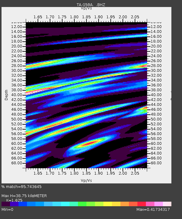
G59A Clarenceville, QC, USA - Earthquake Result Viewer
| ||||||||||||||||||
| ||||||||||||||||||
| ||||||||||||||||||
|
Signal To Noise
| Channel | StoN | STA | LTA |
| TA:G59A: :BHZ:20140310T05:24:57.324988Z | 8.109616 | 2.4545318E-6 | 3.026693E-7 |
| TA:G59A: :BHN:20140310T05:24:57.324988Z | 1.4947603 | 1.5660637E-6 | 1.0477023E-6 |
| TA:G59A: :BHE:20140310T05:24:57.324988Z | 2.8263586 | 1.1213258E-6 | 3.967387E-7 |
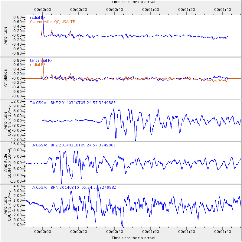
| Arrivals | |
| Ps | 4.1 SECOND |
| PpPs | 15 SECOND |
| PsPs/PpSs | 19 SECOND |

