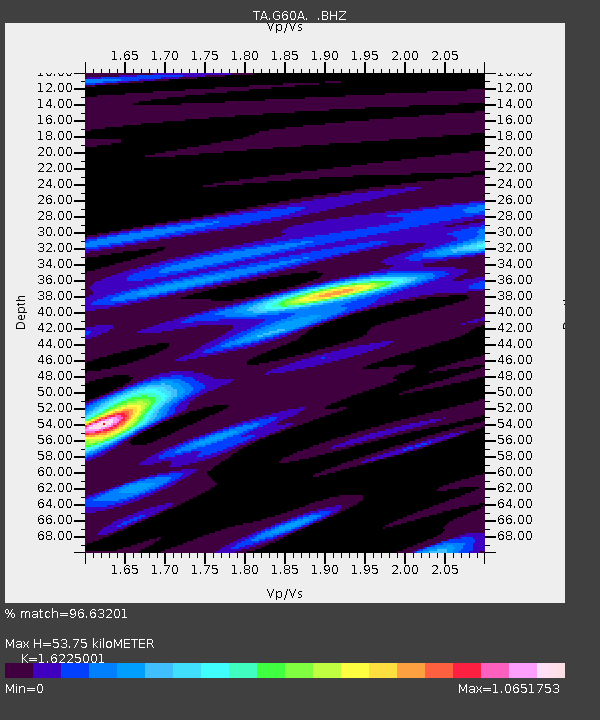
G60A Masonville, QC, CAN - Earthquake Result Viewer
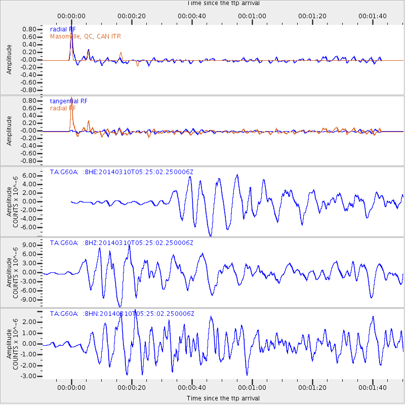
Earthquake location: Off Coast Of Northern California
Earthquake latitude/longitude: 40.8/-125.1
Earthquake time(UTC): 2014/03/10 (069) 05:18:13 GMT
Earthquake Depth: 17 km
Earthquake Magnitude: 6.8 MW, 6.8 MWR, 6.9 MWW, 6.9 MWB, 7.0 MI, 7.0 MWC
Earthquake Catalog/Contributor: NEIC PDE/NEIC COMCAT
Network: TA USArray Transportable Network (new EarthScope stations)
Station: G60A Masonville, QC, CAN
Lat/Lon: 45.10 N/72.33 W
Elevation: 391 m
Distance: 38.3 deg
Az: 65.526 deg
Baz: 282.808 deg
Ray Param: 0.07562144
Estimated Moho Depth: 53.75 km
Estimated Crust Vp/Vs: 1.62
Assumed Crust Vp: 6.419 km/s
Estimated Crust Vs: 3.956 km/s
Estimated Crust Poisson's Ratio: 0.19
Radial Match: 96.63201 %
Radial Bump: 360
Transverse Match: 80.34202 %
Transverse Bump: 400
SOD ConfigId: 626651
Insert Time: 2014-04-21 03:11:08.842 +0000
GWidth: 2.5
Max Bumps: 400
Tol: 0.001

Signal To Noise

ChannelStoNSTALTA
TA:G60A: :BHZ:20140310T05:25:02.250006Z7.71232032.038636E-62.6433497E-7
TA:G60A: :BHN:20140310T05:25:02.250006Z1.86646713.233913E-71.7326386E-7
TA:G60A: :BHE:20140310T05:25:02.250006Z4.98583271.3524584E-62.712603E-7
Arrivals
Ps5.6 SECOND
PpPs20 SECOND
PsPs/PpSs26 SECOND