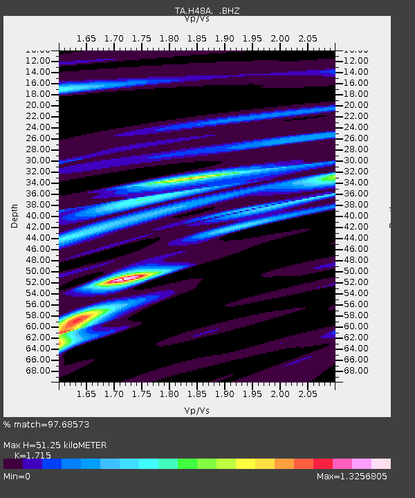
H48A Harrisville, MI, USA - Earthquake Result Viewer

Earthquake location: Off Coast Of Northern California
Earthquake latitude/longitude: 40.8/-125.1
Earthquake time(UTC): 2014/03/10 (069) 05:18:13 GMT
Earthquake Depth: 17 km
Earthquake Magnitude: 6.8 MW, 6.8 MWR, 6.9 MWW, 6.9 MWB, 7.0 MI, 7.0 MWC
Earthquake Catalog/Contributor: NEIC PDE/NEIC COMCAT
Network: TA USArray Transportable Network (new EarthScope stations)
Station: H48A Harrisville, MI, USA
Lat/Lon: 44.70 N/83.32 W
Elevation: 244 m
Distance: 30.7 deg
Az: 68.659 deg
Baz: 277.651 deg
Ray Param: 0.07925727
Estimated Moho Depth: 51.25 km
Estimated Crust Vp/Vs: 1.72
Assumed Crust Vp: 6.483 km/s
Estimated Crust Vs: 3.78 km/s
Estimated Crust Poisson's Ratio: 0.24
Radial Match: 97.68573 %
Radial Bump: 356
Transverse Match: 92.432526 %
Transverse Bump: 400
SOD ConfigId: 626651
Insert Time: 2014-04-21 03:11:23.164 +0000
GWidth: 2.5
Max Bumps: 400
Tol: 0.001

Signal To Noise

ChannelStoNSTALTA
TA:H48A: :BHZ:20140310T05:23:56.574988Z14.9937483.798275E-62.5332392E-7
TA:H48A: :BHN:20140310T05:23:56.574988Z1.2432692.7296633E-72.1955532E-7
TA:H48A: :BHE:20140310T05:23:56.574988Z13.9113952.460091E-61.7684E-7
Arrivals
Ps6.2 SECOND
PpPs20 SECOND
PsPs/PpSs26 SECOND