J49A Marlette, MI, USA - Earthquake Result Viewer
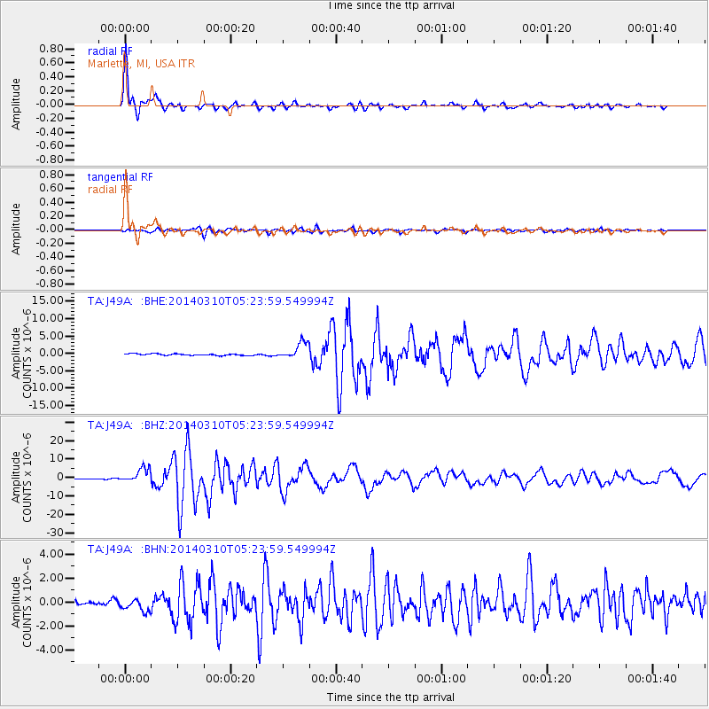
Earthquake location: Off Coast Of Northern California
Earthquake latitude/longitude: 40.8/-125.1
Earthquake time(UTC): 2014/03/10 (069) 05:18:13 GMT
Earthquake Depth: 17 km
Earthquake Magnitude: 6.8 MW, 6.8 MWR, 6.9 MWW, 6.9 MWB, 7.0 MI, 7.0 MWC
Earthquake Catalog/Contributor: NEIC PDE/NEIC COMCAT
Network: TA USArray Transportable Network (new EarthScope stations)
Station: J49A Marlette, MI, USA
Lat/Lon: 43.36 N/83.14 W
Elevation: 253 m
Distance: 31.0 deg
Az: 71.201 deg
Baz: 279.963 deg
Ray Param: 0.07916852
Estimated Moho Depth: 39.25 km
Estimated Crust Vp/Vs: 1.89
Assumed Crust Vp: 6.483 km/s
Estimated Crust Vs: 3.421 km/s
Estimated Crust Poisson's Ratio: 0.31
Radial Match: 97.90222 %
Radial Bump: 362
Transverse Match: 90.74619 %
Transverse Bump: 400
SOD ConfigId: 626651
Insert Time: 2014-04-21 03:12:30.893 +0000
GWidth: 2.5
Max Bumps: 400
Tol: 0.001

Signal To Noise

ChannelStoNSTALTA
TA:J49A: :BHZ:20140310T05:23:59.549994Z16.5496853.861119E-62.3330468E-7
TA:J49A: :BHN:20140310T05:23:59.549994Z2.7861995.589668E-72.0061984E-7
TA:J49A: :BHE:20140310T05:23:59.549994Z10.2885452.4048475E-62.3374031E-7
Arrivals
Ps5.8 SECOND
PpPs16 SECOND
PsPs/PpSs22 SECOND