
J57A Williamstown, NY, USA - Earthquake Result Viewer
| ||||||||||||||||||
| ||||||||||||||||||
| ||||||||||||||||||
|
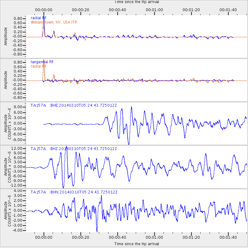
Signal To Noise
| Channel | StoN | STA | LTA |
| TA:J57A: :BHZ:20140310T05:24:43.725012Z | 20.225042 | 2.9634796E-6 | 1.4652525E-7 |
| TA:J57A: :BHN:20140310T05:24:43.725012Z | 2.8333771 | 4.2844152E-7 | 1.5121232E-7 |
| TA:J57A: :BHE:20140310T05:24:43.725012Z | 10.432459 | 1.979648E-6 | 1.8975852E-7 |
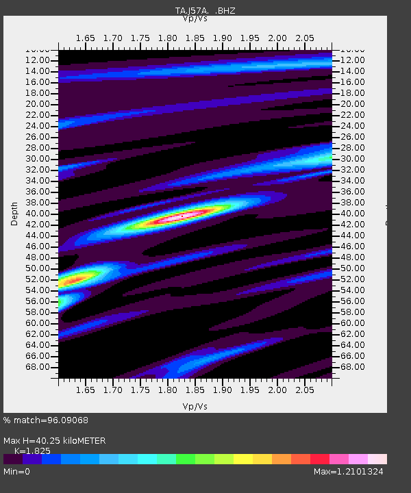
| Arrivals | |
| Ps | 5.6 SECOND |
| PpPs | 16 SECOND |
| PsPs/PpSs | 22 SECOND |

