J61A Chester, VT, USA - Earthquake Result Viewer
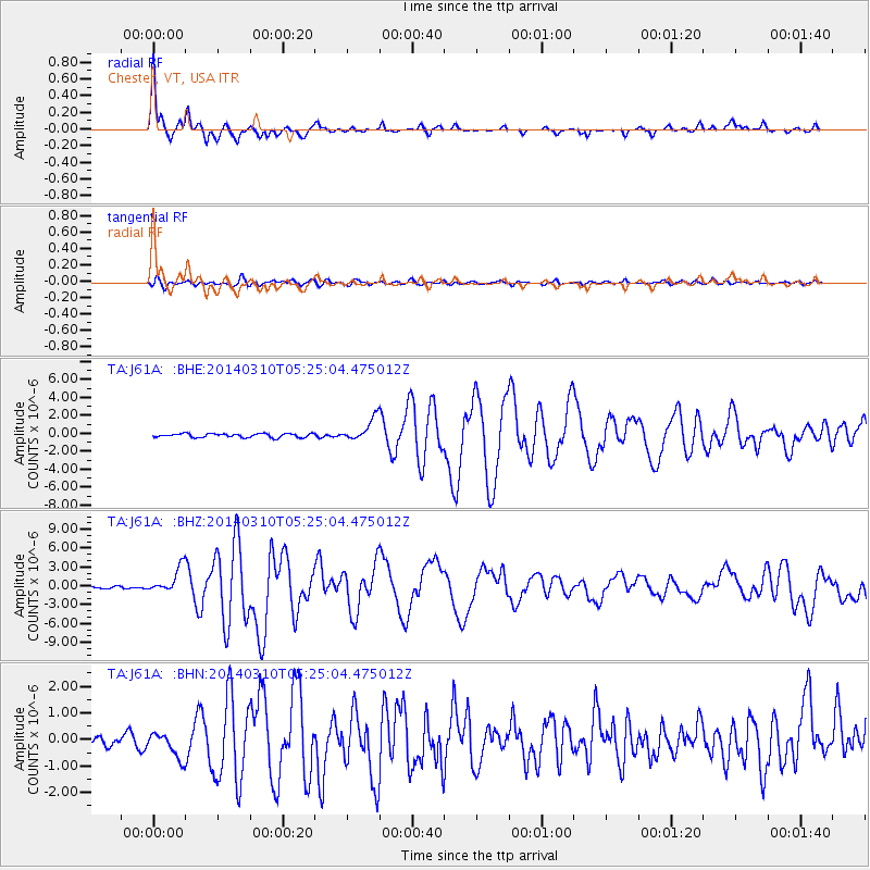
Earthquake location: Off Coast Of Northern California
Earthquake latitude/longitude: 40.8/-125.1
Earthquake time(UTC): 2014/03/10 (069) 05:18:13 GMT
Earthquake Depth: 17 km
Earthquake Magnitude: 6.8 MW, 6.8 MWR, 6.9 MWW, 6.9 MWB, 7.0 MI, 7.0 MWC
Earthquake Catalog/Contributor: NEIC PDE/NEIC COMCAT
Network: TA USArray Transportable Network (new EarthScope stations)
Station: J61A Chester, VT, USA
Lat/Lon: 43.35 N/72.55 W
Elevation: 253 m
Distance: 38.6 deg
Az: 68.322 deg
Baz: 284.845 deg
Ray Param: 0.075468354
Estimated Moho Depth: 40.0 km
Estimated Crust Vp/Vs: 1.62
Assumed Crust Vp: 6.419 km/s
Estimated Crust Vs: 3.969 km/s
Estimated Crust Poisson's Ratio: 0.19
Radial Match: 94.244736 %
Radial Bump: 257
Transverse Match: 77.977264 %
Transverse Bump: 400
SOD ConfigId: 626651
Insert Time: 2014-04-21 03:12:50.682 +0000
GWidth: 2.5
Max Bumps: 400
Tol: 0.001

Signal To Noise

ChannelStoNSTALTA
TA:J61A: :BHZ:20140310T05:25:04.475012Z8.2558032.0103435E-62.4350672E-7
TA:J61A: :BHN:20140310T05:25:04.475012Z2.11973334.6989646E-72.2167717E-7
TA:J61A: :BHE:20140310T05:25:04.475012Z5.81552931.2398798E-62.1320153E-7
Arrivals
Ps4.2 SECOND
PpPs15 SECOND
PsPs/PpSs19 SECOND