J62A Henniker, NH, USA - Earthquake Result Viewer
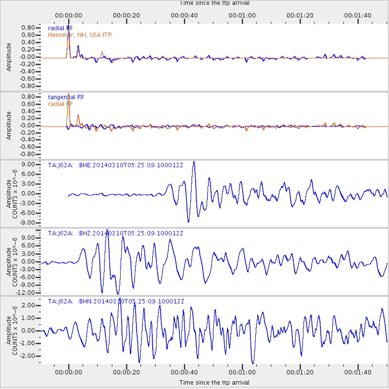
Earthquake location: Off Coast Of Northern California
Earthquake latitude/longitude: 40.8/-125.1
Earthquake time(UTC): 2014/03/10 (069) 05:18:13 GMT
Earthquake Depth: 17 km
Earthquake Magnitude: 6.8 MW, 6.8 MWR, 6.9 MWW, 6.9 MWB, 7.0 MI, 7.0 MWC
Earthquake Catalog/Contributor: NEIC PDE/NEIC COMCAT
Network: TA USArray Transportable Network (new EarthScope stations)
Station: J62A Henniker, NH, USA
Lat/Lon: 43.23 N/71.81 W
Elevation: 266 m
Distance: 39.1 deg
Az: 68.282 deg
Baz: 285.32 deg
Ray Param: 0.07514872
Estimated Moho Depth: 31.75 km
Estimated Crust Vp/Vs: 1.63
Assumed Crust Vp: 6.419 km/s
Estimated Crust Vs: 3.932 km/s
Estimated Crust Poisson's Ratio: 0.20
Radial Match: 95.62083 %
Radial Bump: 279
Transverse Match: 84.1321 %
Transverse Bump: 400
SOD ConfigId: 626651
Insert Time: 2014-04-21 03:12:54.917 +0000
GWidth: 2.5
Max Bumps: 400
Tol: 0.001

Signal To Noise

ChannelStoNSTALTA
TA:J62A: :BHZ:20140310T05:25:09.100012Z4.92756031.7622197E-63.576252E-7
TA:J62A: :BHN:20140310T05:25:09.100012Z2.10004355.0637186E-72.4112447E-7
TA:J62A: :BHE:20140310T05:25:09.100012Z5.40944531.1469485E-62.1202703E-7
Arrivals
Ps3.4 SECOND
PpPs12 SECOND
PsPs/PpSs15 SECOND