K49A Clarkson, MI, USA - Earthquake Result Viewer
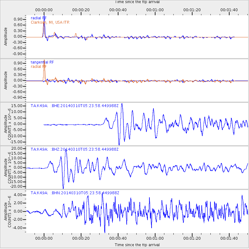
Earthquake location: Off Coast Of Northern California
Earthquake latitude/longitude: 40.8/-125.1
Earthquake time(UTC): 2014/03/10 (069) 05:18:13 GMT
Earthquake Depth: 17 km
Earthquake Magnitude: 6.8 MW, 6.8 MWR, 6.9 MWW, 6.9 MWB, 7.0 MI, 7.0 MWC
Earthquake Catalog/Contributor: NEIC PDE/NEIC COMCAT
Network: TA USArray Transportable Network (new EarthScope stations)
Station: K49A Clarkson, MI, USA
Lat/Lon: 42.78 N/83.46 W
Elevation: 336 m
Distance: 30.9 deg
Az: 72.384 deg
Baz: 280.761 deg
Ray Param: 0.079201266
Estimated Moho Depth: 37.5 km
Estimated Crust Vp/Vs: 2.03
Assumed Crust Vp: 6.483 km/s
Estimated Crust Vs: 3.197 km/s
Estimated Crust Poisson's Ratio: 0.34
Radial Match: 97.32682 %
Radial Bump: 241
Transverse Match: 88.29153 %
Transverse Bump: 400
SOD ConfigId: 626651
Insert Time: 2014-04-21 03:12:59.303 +0000
GWidth: 2.5
Max Bumps: 400
Tol: 0.001

Signal To Noise

ChannelStoNSTALTA
TA:K49A: :BHZ:20140310T05:23:58.449988Z17.3738563.4746952E-61.9999564E-7
TA:K49A: :BHN:20140310T05:23:58.449988Z2.90118276.311682E-72.1755547E-7
TA:K49A: :BHE:20140310T05:23:58.449988Z15.7535662.578878E-61.6370123E-7
Arrivals
Ps6.4 SECOND
PpPs16 SECOND
PsPs/PpSs23 SECOND