K59A Cooperstown, NY, USA - Earthquake Result Viewer
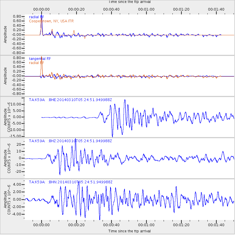
Earthquake location: Off Coast Of Northern California
Earthquake latitude/longitude: 40.8/-125.1
Earthquake time(UTC): 2014/03/10 (069) 05:18:13 GMT
Earthquake Depth: 17 km
Earthquake Magnitude: 6.8 MW, 6.8 MWR, 6.9 MWW, 6.9 MWB, 7.0 MI, 7.0 MWC
Earthquake Catalog/Contributor: NEIC PDE/NEIC COMCAT
Network: TA USArray Transportable Network (new EarthScope stations)
Station: K59A Cooperstown, NY, USA
Lat/Lon: 42.78 N/74.85 W
Elevation: 570 m
Distance: 37.1 deg
Az: 69.919 deg
Baz: 284.543 deg
Ray Param: 0.07631175
Estimated Moho Depth: 30.75 km
Estimated Crust Vp/Vs: 1.86
Assumed Crust Vp: 6.419 km/s
Estimated Crust Vs: 3.461 km/s
Estimated Crust Poisson's Ratio: 0.30
Radial Match: 96.384766 %
Radial Bump: 362
Transverse Match: 87.98276 %
Transverse Bump: 400
SOD ConfigId: 626651
Insert Time: 2014-04-21 03:13:22.773 +0000
GWidth: 2.5
Max Bumps: 400
Tol: 0.001

Signal To Noise

ChannelStoNSTALTA
TA:K59A: :BHZ:20140310T05:24:51.949988Z12.8053423.0710894E-62.3982878E-7
TA:K59A: :BHN:20140310T05:24:51.949988Z1.62406844.1622792E-72.562872E-7
TA:K59A: :BHE:20140310T05:24:51.949988Z7.3179951.802832E-62.46356E-7
Arrivals
Ps4.4 SECOND
PpPs13 SECOND
PsPs/PpSs17 SECOND