K61A Williamstown, MA, USA - Earthquake Result Viewer
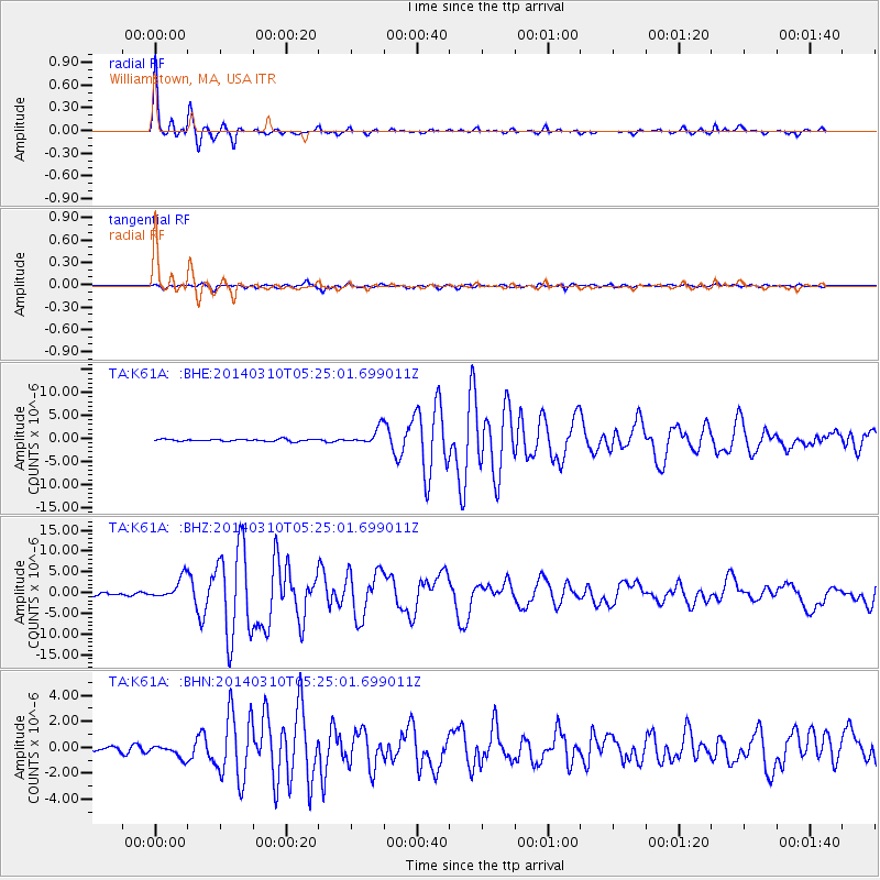
Earthquake location: Off Coast Of Northern California
Earthquake latitude/longitude: 40.8/-125.1
Earthquake time(UTC): 2014/03/10 (069) 05:18:13 GMT
Earthquake Depth: 17 km
Earthquake Magnitude: 6.8 MW, 6.8 MWR, 6.9 MWW, 6.9 MWB, 7.0 MI, 7.0 MWC
Earthquake Catalog/Contributor: NEIC PDE/NEIC COMCAT
Network: TA USArray Transportable Network (new EarthScope stations)
Station: K61A Williamstown, MA, USA
Lat/Lon: 42.67 N/73.27 W
Elevation: 391 m
Distance: 38.2 deg
Az: 69.593 deg
Baz: 285.356 deg
Ray Param: 0.07565866
Estimated Moho Depth: 14.75 km
Estimated Crust Vp/Vs: 1.60
Assumed Crust Vp: 6.419 km/s
Estimated Crust Vs: 4.012 km/s
Estimated Crust Poisson's Ratio: 0.18
Radial Match: 97.67537 %
Radial Bump: 232
Transverse Match: 90.06599 %
Transverse Bump: 400
SOD ConfigId: 626651
Insert Time: 2014-04-21 03:13:26.981 +0000
GWidth: 2.5
Max Bumps: 400
Tol: 0.001

Signal To Noise

ChannelStoNSTALTA
TA:K61A: :BHZ:20140310T05:25:01.699011Z10.06053452.5559993E-62.5406197E-7
TA:K61A: :BHN:20140310T05:25:01.699011Z2.4754244.9295915E-71.9914128E-7
TA:K61A: :BHE:20140310T05:25:01.699011Z7.9047861.724254E-62.1812785E-7
Arrivals
Ps1.5 SECOND
PpPs5.5 SECOND
PsPs/PpSs7.0 SECOND