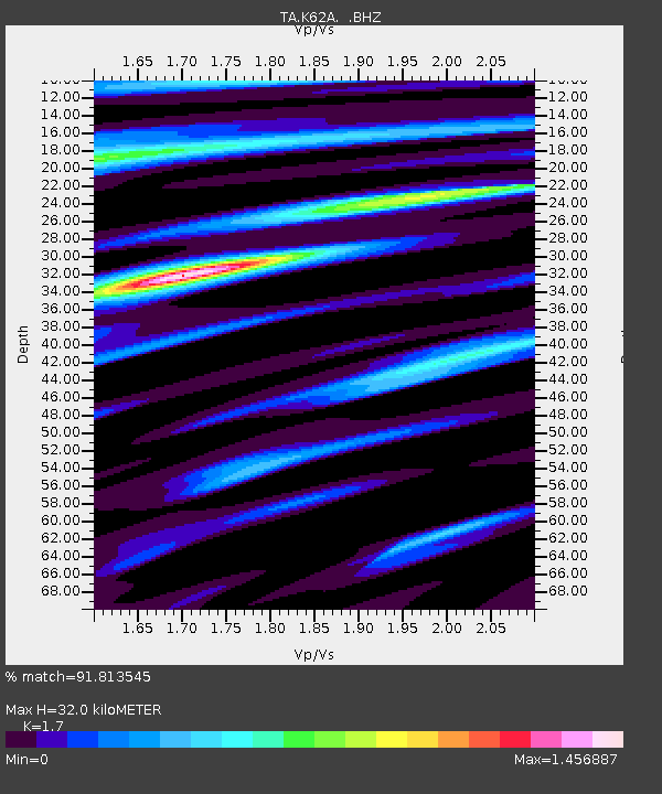
K62A Royalston, MA, USA - Earthquake Result Viewer
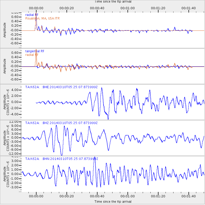
Earthquake location: Off Coast Of Northern California
Earthquake latitude/longitude: 40.8/-125.1
Earthquake time(UTC): 2014/03/10 (069) 05:18:13 GMT
Earthquake Depth: 17 km
Earthquake Magnitude: 6.8 MW, 6.8 MWR, 6.9 MWW, 6.9 MWB, 7.0 MI, 7.0 MWC
Earthquake Catalog/Contributor: NEIC PDE/NEIC COMCAT
Network: TA USArray Transportable Network (new EarthScope stations)
Station: K62A Royalston, MA, USA
Lat/Lon: 42.67 N/72.23 W
Elevation: 289 m
Distance: 39.0 deg
Az: 69.272 deg
Baz: 285.803 deg
Ray Param: 0.07523413
Estimated Moho Depth: 32.0 km
Estimated Crust Vp/Vs: 1.70
Assumed Crust Vp: 6.419 km/s
Estimated Crust Vs: 3.776 km/s
Estimated Crust Poisson's Ratio: 0.24
Radial Match: 91.813545 %
Radial Bump: 357
Transverse Match: 82.17842 %
Transverse Bump: 400
SOD ConfigId: 626651
Insert Time: 2014-04-21 03:13:28.910 +0000
GWidth: 2.5
Max Bumps: 400
Tol: 0.001

Signal To Noise

ChannelStoNSTALTA
TA:K62A: :BHZ:20140310T05:25:07.873999Z7.35244662.1653743E-62.9451073E-7
TA:K62A: :BHN:20140310T05:25:07.873999Z1.70831314.5930295E-72.6886343E-7
TA:K62A: :BHE:20140310T05:25:07.873999Z4.5725771.1460181E-62.506285E-7
Arrivals
Ps3.8 SECOND
PpPs12 SECOND
PsPs/PpSs16 SECOND