L48A N Adams, MI, USA - Earthquake Result Viewer
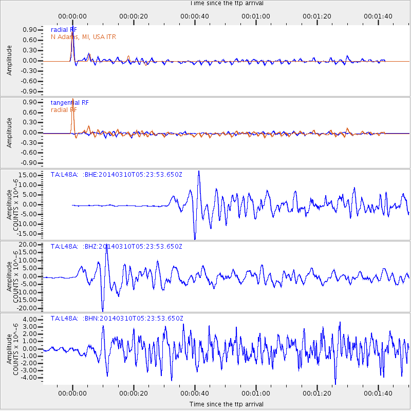
Earthquake location: Off Coast Of Northern California
Earthquake latitude/longitude: 40.8/-125.1
Earthquake time(UTC): 2014/03/10 (069) 05:18:13 GMT
Earthquake Depth: 17 km
Earthquake Magnitude: 6.8 MW, 6.8 MWR, 6.9 MWW, 6.9 MWB, 7.0 MI, 7.0 MWC
Earthquake Catalog/Contributor: NEIC PDE/NEIC COMCAT
Network: TA USArray Transportable Network (new EarthScope stations)
Station: L48A N Adams, MI, USA
Lat/Lon: 41.94 N/84.43 W
Elevation: 369 m
Distance: 30.4 deg
Az: 74.276 deg
Baz: 281.734 deg
Ray Param: 0.0793449
Estimated Moho Depth: 35.75 km
Estimated Crust Vp/Vs: 1.92
Assumed Crust Vp: 6.498 km/s
Estimated Crust Vs: 3.384 km/s
Estimated Crust Poisson's Ratio: 0.31
Radial Match: 95.26509 %
Radial Bump: 323
Transverse Match: 83.90321 %
Transverse Bump: 400
SOD ConfigId: 626651
Insert Time: 2014-04-21 03:13:36.215 +0000
GWidth: 2.5
Max Bumps: 400
Tol: 0.001

Signal To Noise

ChannelStoNSTALTA
TA:L48A: :BHZ:20140310T05:23:53.650Z17.0468623.3810236E-61.98337E-7
TA:L48A: :BHN:20140310T05:23:53.650Z2.7831284.702943E-71.6898048E-7
TA:L48A: :BHE:20140310T05:23:53.650Z15.0147792.3410648E-61.5591738E-7
Arrivals
Ps5.5 SECOND
PpPs15 SECOND
PsPs/PpSs20 SECOND