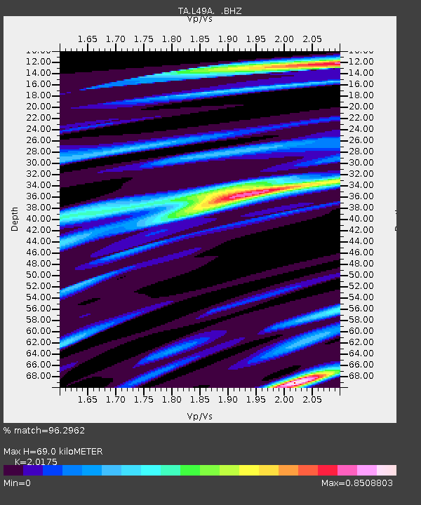
L49A Milan, MI, USA - Earthquake Result Viewer
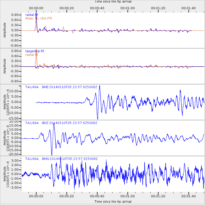
Earthquake location: Off Coast Of Northern California
Earthquake latitude/longitude: 40.8/-125.1
Earthquake time(UTC): 2014/03/10 (069) 05:18:13 GMT
Earthquake Depth: 17 km
Earthquake Magnitude: 6.8 MW, 6.8 MWR, 6.9 MWW, 6.9 MWB, 7.0 MI, 7.0 MWC
Earthquake Catalog/Contributor: NEIC PDE/NEIC COMCAT
Network: TA USArray Transportable Network (new EarthScope stations)
Station: L49A Milan, MI, USA
Lat/Lon: 42.11 N/83.77 W
Elevation: 230 m
Distance: 30.8 deg
Az: 73.761 deg
Baz: 281.734 deg
Ray Param: 0.079226136
Estimated Moho Depth: 69.0 km
Estimated Crust Vp/Vs: 2.02
Assumed Crust Vp: 6.483 km/s
Estimated Crust Vs: 3.213 km/s
Estimated Crust Poisson's Ratio: 0.34
Radial Match: 96.2962 %
Radial Bump: 233
Transverse Match: 81.43062 %
Transverse Bump: 400
SOD ConfigId: 626651
Insert Time: 2014-04-21 03:13:39.916 +0000
GWidth: 2.5
Max Bumps: 400
Tol: 0.001

Signal To Noise

ChannelStoNSTALTA
TA:L49A: :BHZ:20140310T05:23:57.625006Z19.179813.4227592E-61.7845636E-7
TA:L49A: :BHN:20140310T05:23:57.625006Z1.99111323.5402948E-71.778048E-7
TA:L49A: :BHE:20140310T05:23:57.625006Z13.1722242.2652732E-61.7197348E-7
Arrivals
Ps12 SECOND
PpPs30 SECOND
PsPs/PpSs42 SECOND