
L53A Girard, PA, USA - Earthquake Result Viewer
| ||||||||||||||||||
| ||||||||||||||||||
| ||||||||||||||||||
|
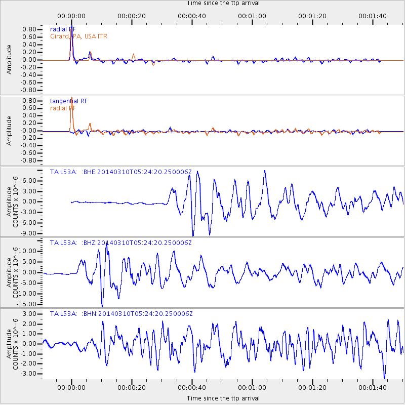
Signal To Noise
| Channel | StoN | STA | LTA |
| TA:L53A: :BHZ:20140310T05:24:20.250006Z | 19.434137 | 3.2730811E-6 | 1.6841916E-7 |
| TA:L53A: :BHN:20140310T05:24:20.250006Z | 1.4341097 | 3.2796197E-7 | 2.286868E-7 |
| TA:L53A: :BHE:20140310T05:24:20.250006Z | 11.322033 | 2.0804669E-6 | 1.8375381E-7 |
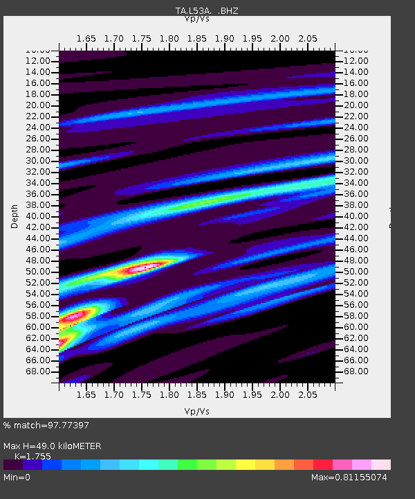
| Arrivals | |
| Ps | 6.2 SECOND |
| PpPs | 19 SECOND |
| PsPs/PpSs | 25 SECOND |

