M52A Chesterland, OH, USA - Earthquake Result Viewer
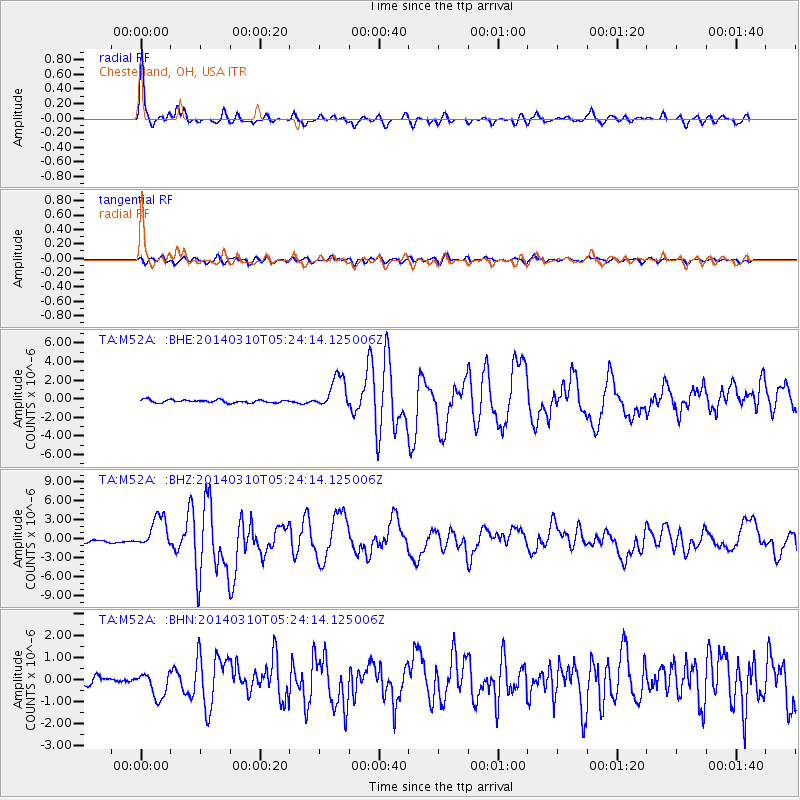
Earthquake location: Off Coast Of Northern California
Earthquake latitude/longitude: 40.8/-125.1
Earthquake time(UTC): 2014/03/10 (069) 05:18:13 GMT
Earthquake Depth: 17 km
Earthquake Magnitude: 6.8 MW, 6.8 MWR, 6.9 MWW, 6.9 MWB, 7.0 MI, 7.0 MWC
Earthquake Catalog/Contributor: NEIC PDE/NEIC COMCAT
Network: TA USArray Transportable Network (new EarthScope stations)
Station: M52A Chesterland, OH, USA
Lat/Lon: 41.54 N/81.36 W
Elevation: 382 m
Distance: 32.7 deg
Az: 74.063 deg
Baz: 283.592 deg
Ray Param: 0.07853059
Estimated Moho Depth: 37.75 km
Estimated Crust Vp/Vs: 1.99
Assumed Crust Vp: 6.483 km/s
Estimated Crust Vs: 3.262 km/s
Estimated Crust Poisson's Ratio: 0.33
Radial Match: 93.54699 %
Radial Bump: 275
Transverse Match: 79.47666 %
Transverse Bump: 400
SOD ConfigId: 626651
Insert Time: 2014-04-21 03:14:22.667 +0000
GWidth: 2.5
Max Bumps: 400
Tol: 0.001

Signal To Noise

ChannelStoNSTALTA
TA:M52A: :BHZ:20140310T05:24:14.125006Z14.6388582.531814E-61.7295162E-7
TA:M52A: :BHN:20140310T05:24:14.125006Z3.7482735.6617824E-71.5105043E-7
TA:M52A: :BHE:20140310T05:24:14.125006Z10.92622951.7511427E-61.6026962E-7
Arrivals
Ps6.2 SECOND
PpPs16 SECOND
PsPs/PpSs22 SECOND