
M53A WI Miller and Sons, Farmdale, OH, USA - Earthquake Result Viewer
| ||||||||||||||||||
| ||||||||||||||||||
| ||||||||||||||||||
|
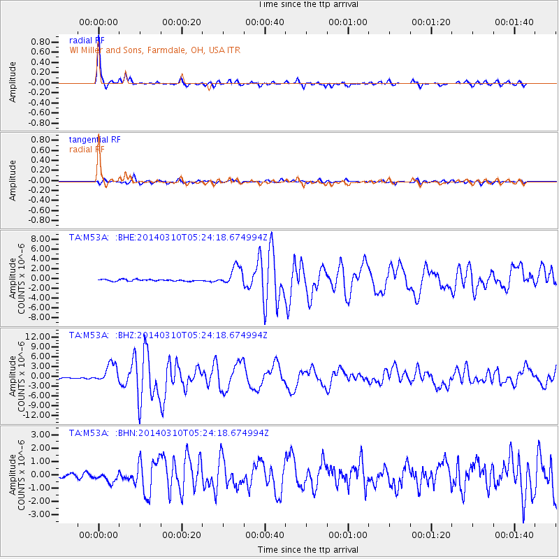
Signal To Noise
| Channel | StoN | STA | LTA |
| TA:M53A: :BHZ:20140310T05:24:18.674994Z | 12.174524 | 2.9764456E-6 | 2.4448147E-7 |
| TA:M53A: :BHN:20140310T05:24:18.674994Z | 2.5570211 | 4.287998E-7 | 1.6769505E-7 |
| TA:M53A: :BHE:20140310T05:24:18.674994Z | 12.3092165 | 1.994634E-6 | 1.6204395E-7 |
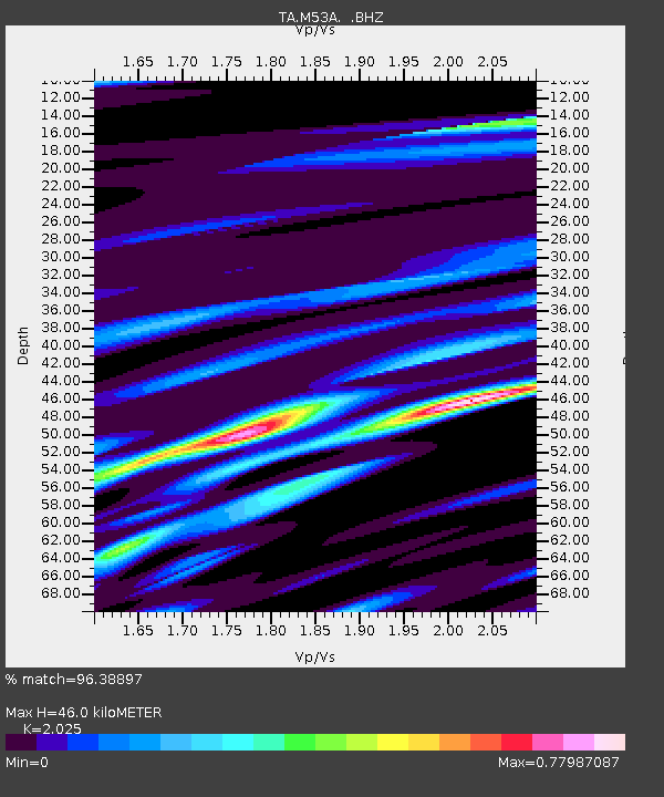
| Arrivals | |
| Ps | 7.8 SECOND |
| PpPs | 20 SECOND |
| PsPs/PpSs | 28 SECOND |

