M54A Oil Creek State Park, Oil City, PA, USA - Earthquake Result Viewer
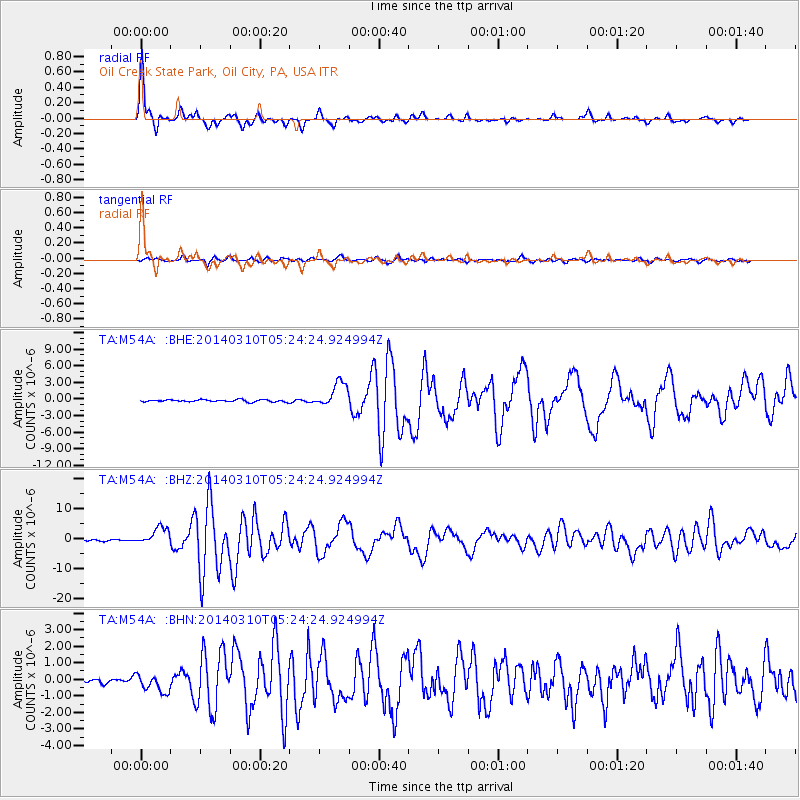
Earthquake location: Off Coast Of Northern California
Earthquake latitude/longitude: 40.8/-125.1
Earthquake time(UTC): 2014/03/10 (069) 05:18:13 GMT
Earthquake Depth: 17 km
Earthquake Magnitude: 6.8 MW, 6.8 MWR, 6.9 MWW, 6.9 MWB, 7.0 MI, 7.0 MWC
Earthquake Catalog/Contributor: NEIC PDE/NEIC COMCAT
Network: TA USArray Transportable Network (new EarthScope stations)
Station: M54A Oil Creek State Park, Oil City, PA, USA
Lat/Lon: 41.51 N/79.66 W
Elevation: 488 m
Distance: 33.9 deg
Az: 73.563 deg
Baz: 284.292 deg
Ray Param: 0.07796548
Estimated Moho Depth: 45.25 km
Estimated Crust Vp/Vs: 1.89
Assumed Crust Vp: 6.121 km/s
Estimated Crust Vs: 3.234 km/s
Estimated Crust Poisson's Ratio: 0.31
Radial Match: 96.579 %
Radial Bump: 284
Transverse Match: 80.35613 %
Transverse Bump: 400
SOD ConfigId: 626651
Insert Time: 2014-04-21 03:14:26.613 +0000
GWidth: 2.5
Max Bumps: 400
Tol: 0.001

Signal To Noise

ChannelStoNSTALTA
TA:M54A: :BHZ:20140310T05:24:24.924994Z11.501032.9063272E-62.5270148E-7
TA:M54A: :BHN:20140310T05:24:24.924994Z2.84176285.5311517E-71.9463806E-7
TA:M54A: :BHE:20140310T05:24:24.924994Z11.9343932.2453619E-61.8814212E-7
Arrivals
Ps7.0 SECOND
PpPs20 SECOND
PsPs/PpSs27 SECOND