M62A Hamden, CT, USA - Earthquake Result Viewer
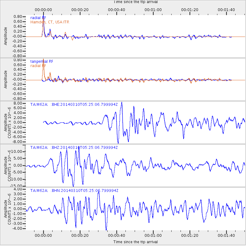
Earthquake location: Off Coast Of Northern California
Earthquake latitude/longitude: 40.8/-125.1
Earthquake time(UTC): 2014/03/10 (069) 05:18:13 GMT
Earthquake Depth: 17 km
Earthquake Magnitude: 6.8 MW, 6.8 MWR, 6.9 MWW, 6.9 MWB, 7.0 MI, 7.0 MWC
Earthquake Catalog/Contributor: NEIC PDE/NEIC COMCAT
Network: TA USArray Transportable Network (new EarthScope stations)
Station: M62A Hamden, CT, USA
Lat/Lon: 41.44 N/72.89 W
Elevation: 24 m
Distance: 38.9 deg
Az: 71.359 deg
Baz: 286.986 deg
Ray Param: 0.07530704
Estimated Moho Depth: 22.25 km
Estimated Crust Vp/Vs: 2.03
Assumed Crust Vp: 6.472 km/s
Estimated Crust Vs: 3.188 km/s
Estimated Crust Poisson's Ratio: 0.34
Radial Match: 95.12863 %
Radial Bump: 349
Transverse Match: 88.5168 %
Transverse Bump: 400
SOD ConfigId: 626651
Insert Time: 2014-04-21 03:14:44.949 +0000
GWidth: 2.5
Max Bumps: 400
Tol: 0.001

Signal To Noise

ChannelStoNSTALTA
TA:M62A: :BHZ:20140310T05:25:06.799994Z7.41040852.7869871E-63.760909E-7
TA:M62A: :BHN:20140310T05:25:06.799994Z1.26964653.2613892E-72.568738E-7
TA:M62A: :BHE:20140310T05:25:06.799994Z4.98950051.7215134E-63.450272E-7
Arrivals
Ps3.8 SECOND
PpPs9.8 SECOND
PsPs/PpSs14 SECOND