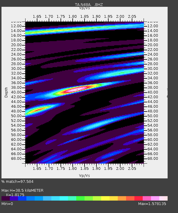
N48A Decatur, IN, USA - Earthquake Result Viewer
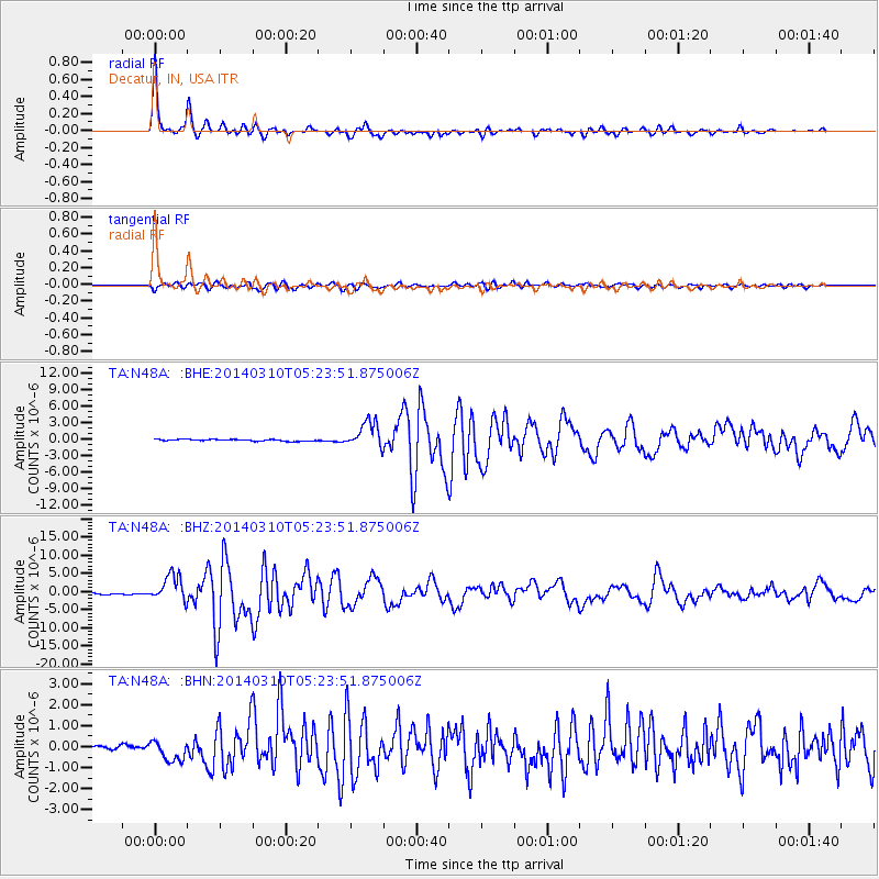
Earthquake location: Off Coast Of Northern California
Earthquake latitude/longitude: 40.8/-125.1
Earthquake time(UTC): 2014/03/10 (069) 05:18:13 GMT
Earthquake Depth: 17 km
Earthquake Magnitude: 6.8 MW, 6.8 MWR, 6.9 MWW, 6.9 MWB, 7.0 MI, 7.0 MWC
Earthquake Catalog/Contributor: NEIC PDE/NEIC COMCAT
Network: TA USArray Transportable Network (new EarthScope stations)
Station: N48A Decatur, IN, USA
Lat/Lon: 40.86 N/85.03 W
Elevation: 250 m
Distance: 30.2 deg
Az: 76.568 deg
Baz: 283.322 deg
Ray Param: 0.07939778
Estimated Moho Depth: 38.5 km
Estimated Crust Vp/Vs: 1.82
Assumed Crust Vp: 6.498 km/s
Estimated Crust Vs: 3.575 km/s
Estimated Crust Poisson's Ratio: 0.28
Radial Match: 97.584 %
Radial Bump: 271
Transverse Match: 88.927986 %
Transverse Bump: 400
SOD ConfigId: 626651
Insert Time: 2014-04-21 03:14:55.542 +0000
GWidth: 2.5
Max Bumps: 400
Tol: 0.001

Signal To Noise

ChannelStoNSTALTA
TA:N48A: :BHZ:20140310T05:23:51.875006Z20.0884723.6516976E-61.8178075E-7
TA:N48A: :BHN:20140310T05:23:51.875006Z4.59122134.941948E-71.07639075E-7
TA:N48A: :BHE:20140310T05:23:51.875006Z15.260062.388536E-61.5652206E-7
Arrivals
Ps5.3 SECOND
PpPs15 SECOND
PsPs/PpSs21 SECOND