
N51A Ashland, OH, USA - Earthquake Result Viewer
| ||||||||||||||||||
| ||||||||||||||||||
| ||||||||||||||||||
|
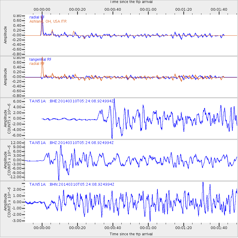
Signal To Noise
| Channel | StoN | STA | LTA |
| TA:N51A: :BHZ:20140310T05:24:08.924994Z | 15.761 | 2.7255262E-6 | 1.729285E-7 |
| TA:N51A: :BHN:20140310T05:24:08.924994Z | 2.919253 | 5.183037E-7 | 1.7754668E-7 |
| TA:N51A: :BHE:20140310T05:24:08.924994Z | 9.228481 | 1.6637076E-6 | 1.8027968E-7 |
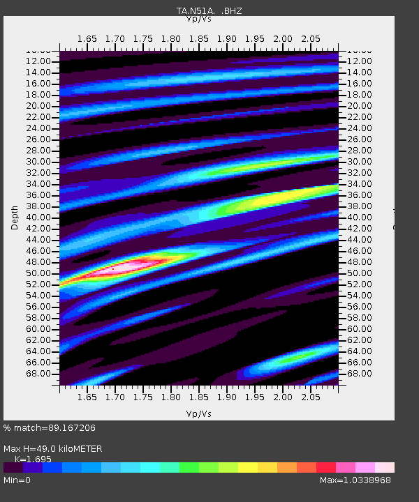
| Arrivals | |
| Ps | 5.7 SECOND |
| PpPs | 19 SECOND |
| PsPs/PpSs | 24 SECOND |

