N56A West Decatur, PA, USA - Earthquake Result Viewer
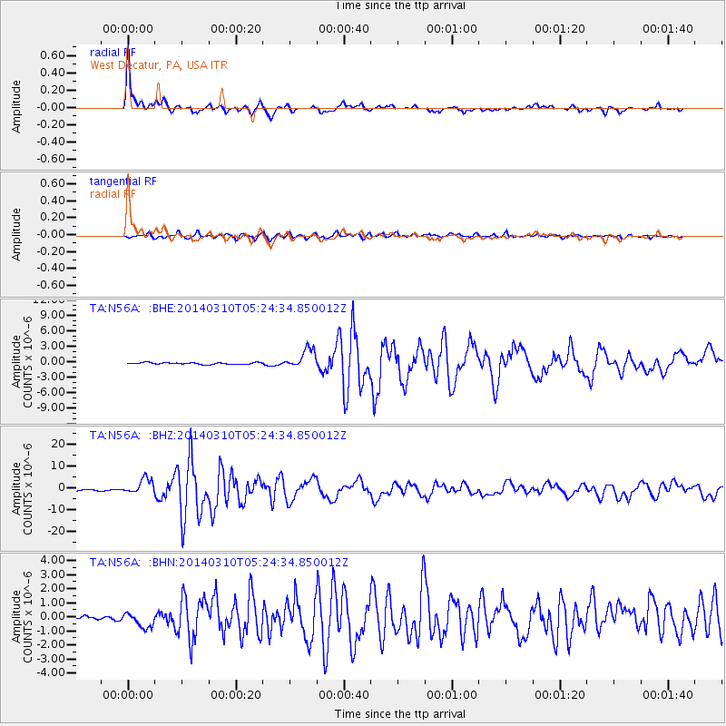
Earthquake location: Off Coast Of Northern California
Earthquake latitude/longitude: 40.8/-125.1
Earthquake time(UTC): 2014/03/10 (069) 05:18:13 GMT
Earthquake Depth: 17 km
Earthquake Magnitude: 6.8 MW, 6.8 MWR, 6.9 MWW, 6.9 MWB, 7.0 MI, 7.0 MWC
Earthquake Catalog/Contributor: NEIC PDE/NEIC COMCAT
Network: TA USArray Transportable Network (new EarthScope stations)
Station: N56A West Decatur, PA, USA
Lat/Lon: 40.92 N/78.30 W
Elevation: 561 m
Distance: 35.1 deg
Az: 74.099 deg
Baz: 285.633 deg
Ray Param: 0.07739218
Estimated Moho Depth: 62.25 km
Estimated Crust Vp/Vs: 1.60
Assumed Crust Vp: 6.121 km/s
Estimated Crust Vs: 3.825 km/s
Estimated Crust Poisson's Ratio: 0.18
Radial Match: 96.652534 %
Radial Bump: 356
Transverse Match: 89.695595 %
Transverse Bump: 400
SOD ConfigId: 626651
Insert Time: 2014-04-21 03:15:13.803 +0000
GWidth: 2.5
Max Bumps: 400
Tol: 0.001

Signal To Noise

ChannelStoNSTALTA
TA:N56A: :BHZ:20140310T05:24:34.850012Z17.0095423.5802143E-62.1048268E-7
TA:N56A: :BHN:20140310T05:24:34.850012Z2.84779245.4334856E-71.9079641E-7
TA:N56A: :BHE:20140310T05:24:34.850012Z11.2132461.929057E-61.7203377E-7
Arrivals
Ps6.6 SECOND
PpPs25 SECOND
PsPs/PpSs31 SECOND