N59A State Game Land 141, Hazleton, PA, USA - Earthquake Result Viewer
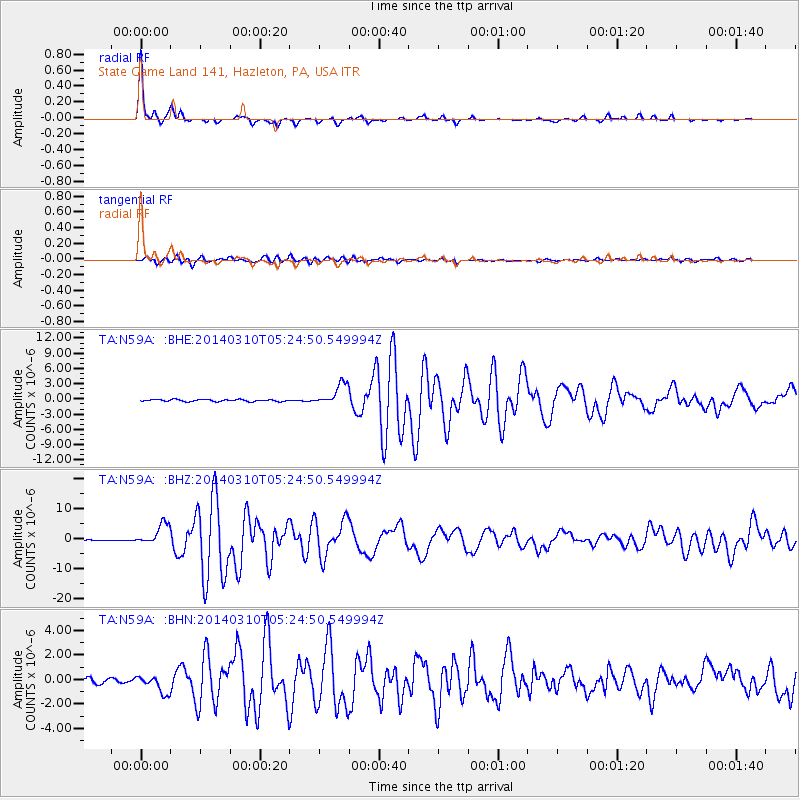
Earthquake location: Off Coast Of Northern California
Earthquake latitude/longitude: 40.8/-125.1
Earthquake time(UTC): 2014/03/10 (069) 05:18:13 GMT
Earthquake Depth: 17 km
Earthquake Magnitude: 6.8 MW, 6.8 MWR, 6.9 MWW, 6.9 MWB, 7.0 MI, 7.0 MWC
Earthquake Catalog/Contributor: NEIC PDE/NEIC COMCAT
Network: TA USArray Transportable Network (new EarthScope stations)
Station: N59A State Game Land 141, Hazleton, PA, USA
Lat/Lon: 40.92 N/75.77 W
Elevation: 508 m
Distance: 36.9 deg
Az: 73.197 deg
Baz: 286.551 deg
Ray Param: 0.07640057
Estimated Moho Depth: 45.0 km
Estimated Crust Vp/Vs: 1.69
Assumed Crust Vp: 6.283 km/s
Estimated Crust Vs: 3.723 km/s
Estimated Crust Poisson's Ratio: 0.23
Radial Match: 96.291885 %
Radial Bump: 185
Transverse Match: 86.11226 %
Transverse Bump: 400
SOD ConfigId: 626651
Insert Time: 2014-04-21 03:15:20.444 +0000
GWidth: 2.5
Max Bumps: 400
Tol: 0.001

Signal To Noise

ChannelStoNSTALTA
TA:N59A: :BHZ:20140310T05:24:50.549994Z14.2023723.519435E-62.4780616E-7
TA:N59A: :BHN:20140310T05:24:50.549994Z3.299177.053487E-72.1379581E-7
TA:N59A: :BHE:20140310T05:24:50.549994Z11.1375512.1441003E-61.9251092E-7
Arrivals
Ps5.3 SECOND
PpPs18 SECOND
PsPs/PpSs23 SECOND