N60A Cedar Hill Farm, Mount Bethel, PA, USA - Earthquake Result Viewer
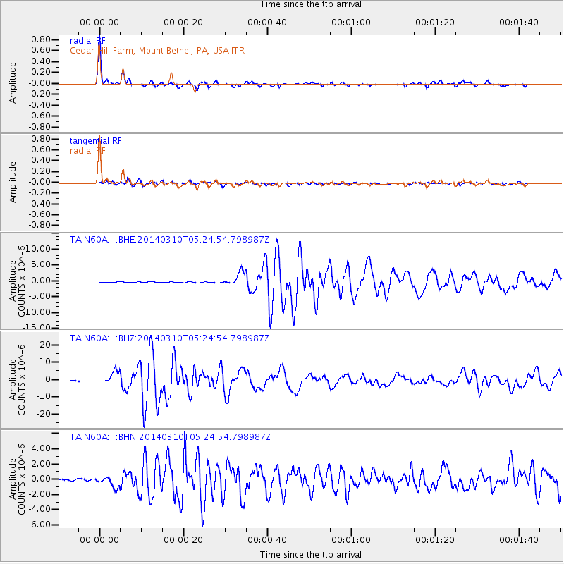
Earthquake location: Off Coast Of Northern California
Earthquake latitude/longitude: 40.8/-125.1
Earthquake time(UTC): 2014/03/10 (069) 05:18:13 GMT
Earthquake Depth: 17 km
Earthquake Magnitude: 6.8 MW, 6.8 MWR, 6.9 MWW, 6.9 MWB, 7.0 MI, 7.0 MWC
Earthquake Catalog/Contributor: NEIC PDE/NEIC COMCAT
Network: TA USArray Transportable Network (new EarthScope stations)
Station: N60A Cedar Hill Farm, Mount Bethel, PA, USA
Lat/Lon: 40.87 N/75.10 W
Elevation: 189 m
Distance: 37.4 deg
Az: 73.029 deg
Baz: 286.854 deg
Ray Param: 0.076128244
Estimated Moho Depth: 32.25 km
Estimated Crust Vp/Vs: 2.05
Assumed Crust Vp: 6.283 km/s
Estimated Crust Vs: 3.065 km/s
Estimated Crust Poisson's Ratio: 0.34
Radial Match: 98.30345 %
Radial Bump: 209
Transverse Match: 90.65527 %
Transverse Bump: 400
SOD ConfigId: 626651
Insert Time: 2014-04-21 03:15:22.004 +0000
GWidth: 2.5
Max Bumps: 400
Tol: 0.001

Signal To Noise

ChannelStoNSTALTA
TA:N60A: :BHZ:20140310T05:24:54.798987Z22.1575783.5482337E-61.6013635E-7
TA:N60A: :BHN:20140310T05:24:54.798987Z5.2670516.953532E-71.3201945E-7
TA:N60A: :BHE:20140310T05:24:54.798987Z22.023762.1650364E-69.830458E-8
Arrivals
Ps5.7 SECOND
PpPs15 SECOND
PsPs/PpSs20 SECOND