O48A Farmland, IN, USA - Earthquake Result Viewer
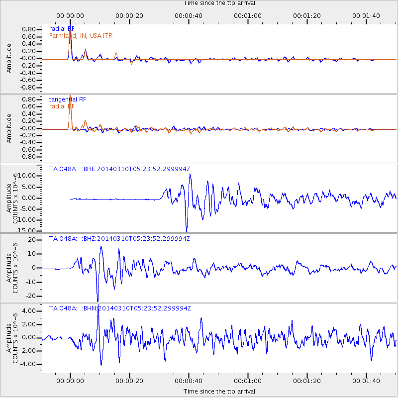
Earthquake location: Off Coast Of Northern California
Earthquake latitude/longitude: 40.8/-125.1
Earthquake time(UTC): 2014/03/10 (069) 05:18:13 GMT
Earthquake Depth: 17 km
Earthquake Magnitude: 6.8 MW, 6.8 MWR, 6.9 MWW, 6.9 MWB, 7.0 MI, 7.0 MWC
Earthquake Catalog/Contributor: NEIC PDE/NEIC COMCAT
Network: TA USArray Transportable Network (new EarthScope stations)
Station: O48A Farmland, IN, USA
Lat/Lon: 40.26 N/85.16 W
Elevation: 300 m
Distance: 30.2 deg
Az: 77.776 deg
Baz: 284.283 deg
Ray Param: 0.07938501
Estimated Moho Depth: 39.5 km
Estimated Crust Vp/Vs: 1.80
Assumed Crust Vp: 6.498 km/s
Estimated Crust Vs: 3.61 km/s
Estimated Crust Poisson's Ratio: 0.28
Radial Match: 98.16977 %
Radial Bump: 238
Transverse Match: 85.62401 %
Transverse Bump: 400
SOD ConfigId: 626651
Insert Time: 2014-04-21 03:15:30.843 +0000
GWidth: 2.5
Max Bumps: 400
Tol: 0.001

Signal To Noise

ChannelStoNSTALTA
TA:O48A: :BHZ:20140310T05:23:52.299994Z24.9142273.6371853E-61.4598828E-7
TA:O48A: :BHN:20140310T05:23:52.299994Z3.4746967.986861E-72.2985783E-7
TA:O48A: :BHE:20140310T05:23:52.299994Z19.4969022.4188064E-61.2406106E-7
Arrivals
Ps5.3 SECOND
PpPs16 SECOND
PsPs/PpSs21 SECOND