O57A Amberson, PA, USA - Earthquake Result Viewer
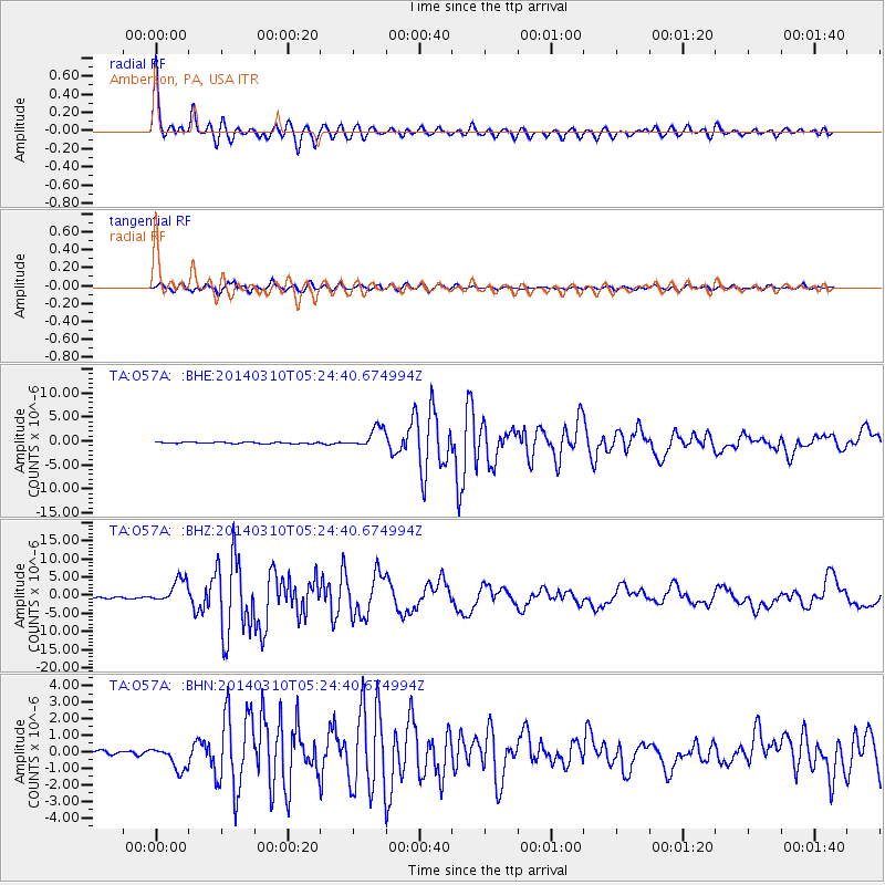
Earthquake location: Off Coast Of Northern California
Earthquake latitude/longitude: 40.8/-125.1
Earthquake time(UTC): 2014/03/10 (069) 05:18:13 GMT
Earthquake Depth: 17 km
Earthquake Magnitude: 6.8 MW, 6.8 MWR, 6.9 MWW, 6.9 MWB, 7.0 MI, 7.0 MWC
Earthquake Catalog/Contributor: NEIC PDE/NEIC COMCAT
Network: TA USArray Transportable Network (new EarthScope stations)
Station: O57A Amberson, PA, USA
Lat/Lon: 40.21 N/77.64 W
Elevation: 377 m
Distance: 35.8 deg
Az: 75.026 deg
Baz: 286.815 deg
Ray Param: 0.07703158
Estimated Moho Depth: 43.75 km
Estimated Crust Vp/Vs: 1.76
Assumed Crust Vp: 6.121 km/s
Estimated Crust Vs: 3.483 km/s
Estimated Crust Poisson's Ratio: 0.26
Radial Match: 92.56963 %
Radial Bump: 400
Transverse Match: 83.054726 %
Transverse Bump: 400
SOD ConfigId: 626651
Insert Time: 2014-04-21 03:15:53.722 +0000
GWidth: 2.5
Max Bumps: 400
Tol: 0.001

Signal To Noise

ChannelStoNSTALTA
TA:O57A: :BHZ:20140310T05:24:40.674994Z15.9661743.3376446E-62.0904473E-7
TA:O57A: :BHN:20140310T05:24:40.674994Z4.23147347.327752E-71.7317261E-7
TA:O57A: :BHE:20140310T05:24:40.674994Z13.9022752.1188291E-61.524088E-7
Arrivals
Ps5.8 SECOND
PpPs18 SECOND
PsPs/PpSs24 SECOND