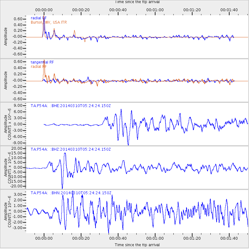
P54A Burton, WV, USA - Earthquake Result Viewer
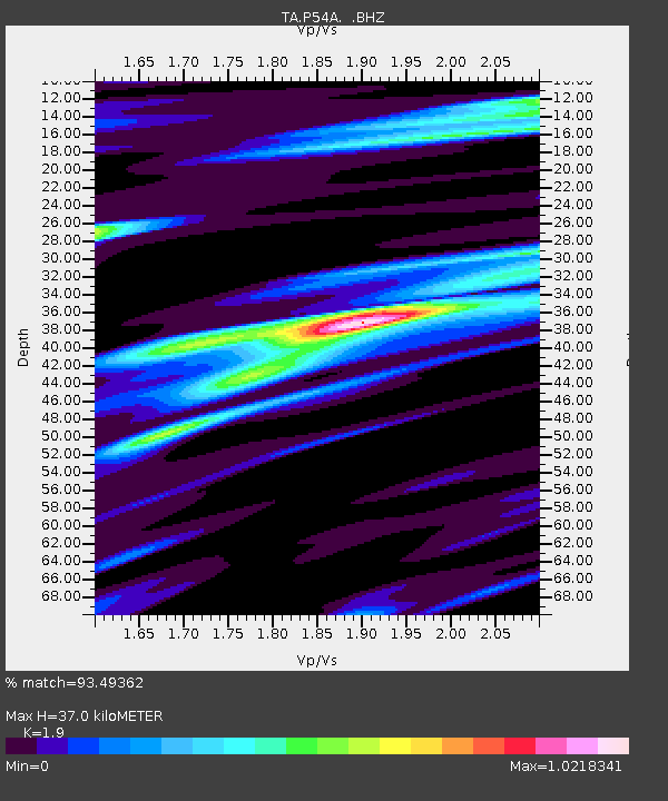
Earthquake location: Off Coast Of Northern California
Earthquake latitude/longitude: 40.8/-125.1
Earthquake time(UTC): 2014/03/10 (069) 05:18:13 GMT
Earthquake Depth: 17 km
Earthquake Magnitude: 6.8 MW, 6.8 MWR, 6.9 MWW, 6.9 MWB, 7.0 MI, 7.0 MWC
Earthquake Catalog/Contributor: NEIC PDE/NEIC COMCAT
Network: TA USArray Transportable Network (new EarthScope stations)
Station: P54A Burton, WV, USA
Lat/Lon: 39.61 N/80.48 W
Elevation: 473 m
Distance: 33.8 deg
Az: 77.139 deg
Baz: 286.733 deg
Ray Param: 0.07800739
Estimated Moho Depth: 37.0 km
Estimated Crust Vp/Vs: 1.90
Assumed Crust Vp: 6.207 km/s
Estimated Crust Vs: 3.267 km/s
Estimated Crust Poisson's Ratio: 0.31
Radial Match: 93.49362 %
Radial Bump: 400
Transverse Match: 79.17306 %
Transverse Bump: 400
SOD ConfigId: 626651
Insert Time: 2014-04-21 03:16:18.569 +0000
GWidth: 2.5
Max Bumps: 400
Tol: 0.001

Signal To Noise

ChannelStoNSTALTA
TA:P54A: :BHZ:20140310T05:24:24.150Z14.6978643.322728E-62.2606878E-7
TA:P54A: :BHN:20140310T05:24:24.150Z2.61392956.116793E-72.3400759E-7
TA:P54A: :BHE:20140310T05:24:24.150Z10.2090741.8738324E-61.8354578E-7
Arrivals
Ps5.7 SECOND
PpPs16 SECOND
PsPs/PpSs22 SECOND