P55A Reedsville, WV, USA - Earthquake Result Viewer
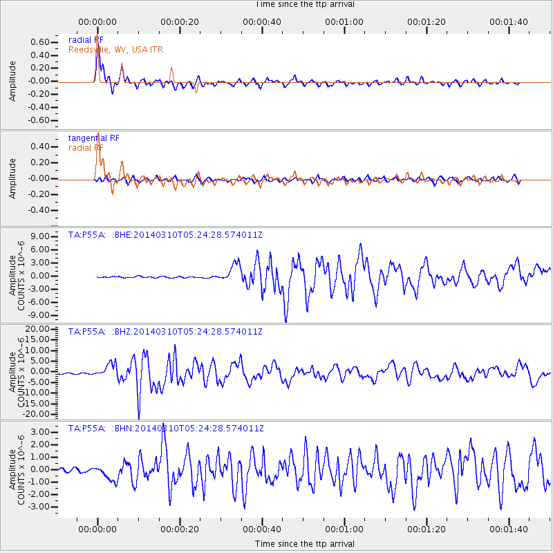
Earthquake location: Off Coast Of Northern California
Earthquake latitude/longitude: 40.8/-125.1
Earthquake time(UTC): 2014/03/10 (069) 05:18:13 GMT
Earthquake Depth: 17 km
Earthquake Magnitude: 6.8 MW, 6.8 MWR, 6.9 MWW, 6.9 MWB, 7.0 MI, 7.0 MWC
Earthquake Catalog/Contributor: NEIC PDE/NEIC COMCAT
Network: TA USArray Transportable Network (new EarthScope stations)
Station: P55A Reedsville, WV, USA
Lat/Lon: 39.51 N/79.83 W
Elevation: 551 m
Distance: 34.4 deg
Az: 77.05 deg
Baz: 287.074 deg
Ray Param: 0.07776903
Estimated Moho Depth: 32.0 km
Estimated Crust Vp/Vs: 2.10
Assumed Crust Vp: 6.159 km/s
Estimated Crust Vs: 2.936 km/s
Estimated Crust Poisson's Ratio: 0.35
Radial Match: 92.69747 %
Radial Bump: 324
Transverse Match: 69.460526 %
Transverse Bump: 400
SOD ConfigId: 626651
Insert Time: 2014-04-21 03:16:22.581 +0000
GWidth: 2.5
Max Bumps: 400
Tol: 0.001

Signal To Noise

ChannelStoNSTALTA
TA:P55A: :BHZ:20140310T05:24:28.574011Z18.3758283.3266303E-61.8103296E-7
TA:P55A: :BHN:20140310T05:24:28.574011Z2.9054366.385818E-72.1978865E-7
TA:P55A: :BHE:20140310T05:24:28.574011Z15.2134242.1272874E-61.3982962E-7
Arrivals
Ps6.0 SECOND
PpPs15 SECOND
PsPs/PpSs21 SECOND