P60A Greenville, DE, USA - Earthquake Result Viewer
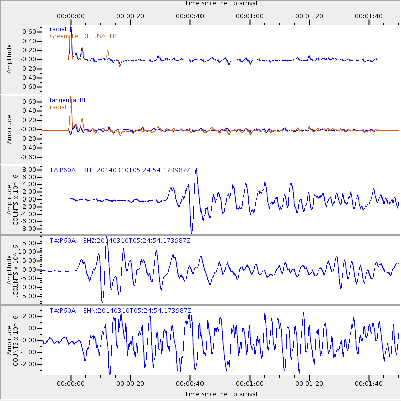
Earthquake location: Off Coast Of Northern California
Earthquake latitude/longitude: 40.8/-125.1
Earthquake time(UTC): 2014/03/10 (069) 05:18:13 GMT
Earthquake Depth: 17 km
Earthquake Magnitude: 6.8 MW, 6.8 MWR, 6.9 MWW, 6.9 MWB, 7.0 MI, 7.0 MWC
Earthquake Catalog/Contributor: NEIC PDE/NEIC COMCAT
Network: TA USArray Transportable Network (new EarthScope stations)
Station: P60A Greenville, DE, USA
Lat/Lon: 39.81 N/75.64 W
Elevation: 105 m
Distance: 37.3 deg
Az: 74.893 deg
Baz: 287.99 deg
Ray Param: 0.07616856
Estimated Moho Depth: 32.25 km
Estimated Crust Vp/Vs: 1.72
Assumed Crust Vp: 6.287 km/s
Estimated Crust Vs: 3.666 km/s
Estimated Crust Poisson's Ratio: 0.24
Radial Match: 94.114716 %
Radial Bump: 337
Transverse Match: 85.19715 %
Transverse Bump: 400
SOD ConfigId: 626651
Insert Time: 2014-04-21 03:16:32.756 +0000
GWidth: 2.5
Max Bumps: 400
Tol: 0.001

Signal To Noise

ChannelStoNSTALTA
TA:P60A: :BHZ:20140310T05:24:54.173987Z19.1521743.1822715E-61.6615719E-7
TA:P60A: :BHN:20140310T05:24:54.173987Z2.90554715.6202293E-71.9343102E-7
TA:P60A: :BHE:20140310T05:24:54.173987Z8.87233451.6905115E-61.9053739E-7
Arrivals
Ps3.9 SECOND
PpPs13 SECOND
PsPs/PpSs17 SECOND