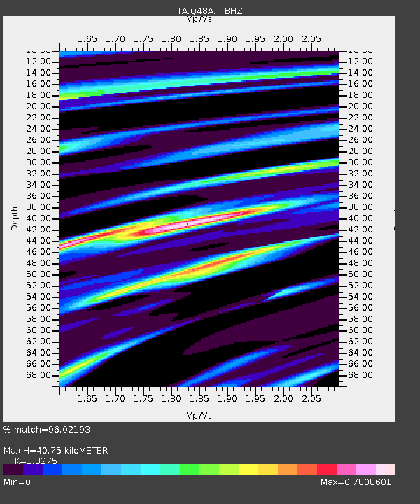
Q48A North Vernon, IN, USA - Earthquake Result Viewer
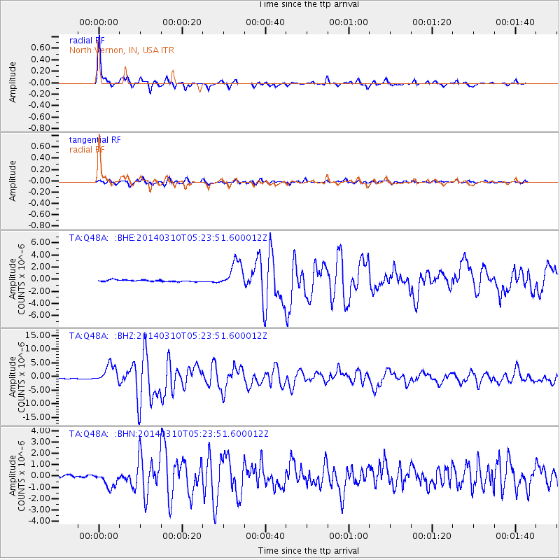
Earthquake location: Off Coast Of Northern California
Earthquake latitude/longitude: 40.8/-125.1
Earthquake time(UTC): 2014/03/10 (069) 05:18:13 GMT
Earthquake Depth: 17 km
Earthquake Magnitude: 6.8 MW, 6.8 MWR, 6.9 MWW, 6.9 MWB, 7.0 MI, 7.0 MWC
Earthquake Catalog/Contributor: NEIC PDE/NEIC COMCAT
Network: TA USArray Transportable Network (new EarthScope stations)
Station: Q48A North Vernon, IN, USA
Lat/Lon: 38.93 N/85.73 W
Elevation: 185 m
Distance: 30.1 deg
Az: 80.555 deg
Baz: 286.32 deg
Ray Param: 0.07940583
Estimated Moho Depth: 40.75 km
Estimated Crust Vp/Vs: 1.83
Assumed Crust Vp: 6.498 km/s
Estimated Crust Vs: 3.555 km/s
Estimated Crust Poisson's Ratio: 0.29
Radial Match: 96.02193 %
Radial Bump: 292
Transverse Match: 87.899635 %
Transverse Bump: 400
SOD ConfigId: 626651
Insert Time: 2014-04-21 03:16:37.126 +0000
GWidth: 2.5
Max Bumps: 400
Tol: 0.001

Signal To Noise

ChannelStoNSTALTA
TA:Q48A: :BHZ:20140310T05:23:51.600012Z20.1106513.4345553E-61.707829E-7
TA:Q48A: :BHN:20140310T05:23:51.600012Z6.63777977.175801E-71.08105446E-7
TA:Q48A: :BHE:20140310T05:23:51.600012Z17.1102712.2431343E-61.310987E-7
Arrivals
Ps5.6 SECOND
PpPs16 SECOND
PsPs/PpSs22 SECOND