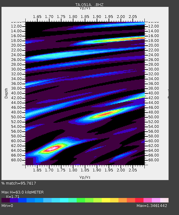
Q51A Peebles, OH, USA - Earthquake Result Viewer
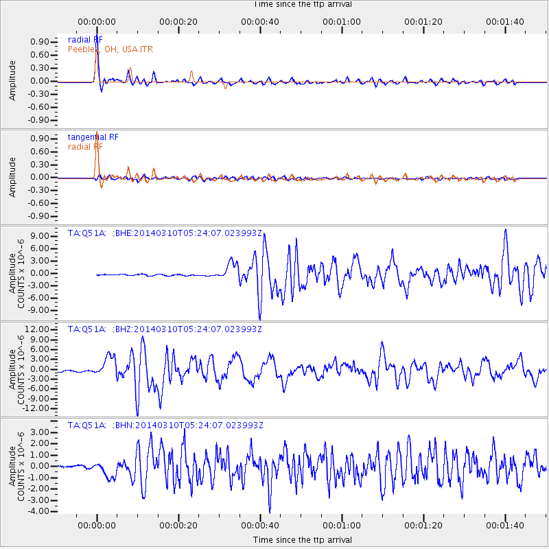
Earthquake location: Off Coast Of Northern California
Earthquake latitude/longitude: 40.8/-125.1
Earthquake time(UTC): 2014/03/10 (069) 05:18:13 GMT
Earthquake Depth: 17 km
Earthquake Magnitude: 6.8 MW, 6.8 MWR, 6.9 MWW, 6.9 MWB, 7.0 MI, 7.0 MWC
Earthquake Catalog/Contributor: NEIC PDE/NEIC COMCAT
Network: TA USArray Transportable Network (new EarthScope stations)
Station: Q51A Peebles, OH, USA
Lat/Lon: 39.03 N/83.35 W
Elevation: 362 m
Distance: 31.9 deg
Az: 79.348 deg
Baz: 286.78 deg
Ray Param: 0.07887546
Estimated Moho Depth: 63.0 km
Estimated Crust Vp/Vs: 1.71
Assumed Crust Vp: 6.232 km/s
Estimated Crust Vs: 3.644 km/s
Estimated Crust Poisson's Ratio: 0.24
Radial Match: 95.7617 %
Radial Bump: 353
Transverse Match: 82.217415 %
Transverse Bump: 400
SOD ConfigId: 626651
Insert Time: 2014-04-21 03:16:46.084 +0000
GWidth: 2.5
Max Bumps: 400
Tol: 0.001

Signal To Noise

ChannelStoNSTALTA
TA:Q51A: :BHZ:20140310T05:24:07.023993Z14.8449673.1931547E-62.1510017E-7
TA:Q51A: :BHN:20140310T05:24:07.023993Z4.8194757.1256767E-71.4785172E-7
TA:Q51A: :BHE:20140310T05:24:07.023993Z13.7337652.1553035E-61.5693466E-7
Arrivals
Ps7.8 SECOND
PpPs25 SECOND
PsPs/PpSs33 SECOND