R51A Hillsboro, KY, USA - Earthquake Result Viewer
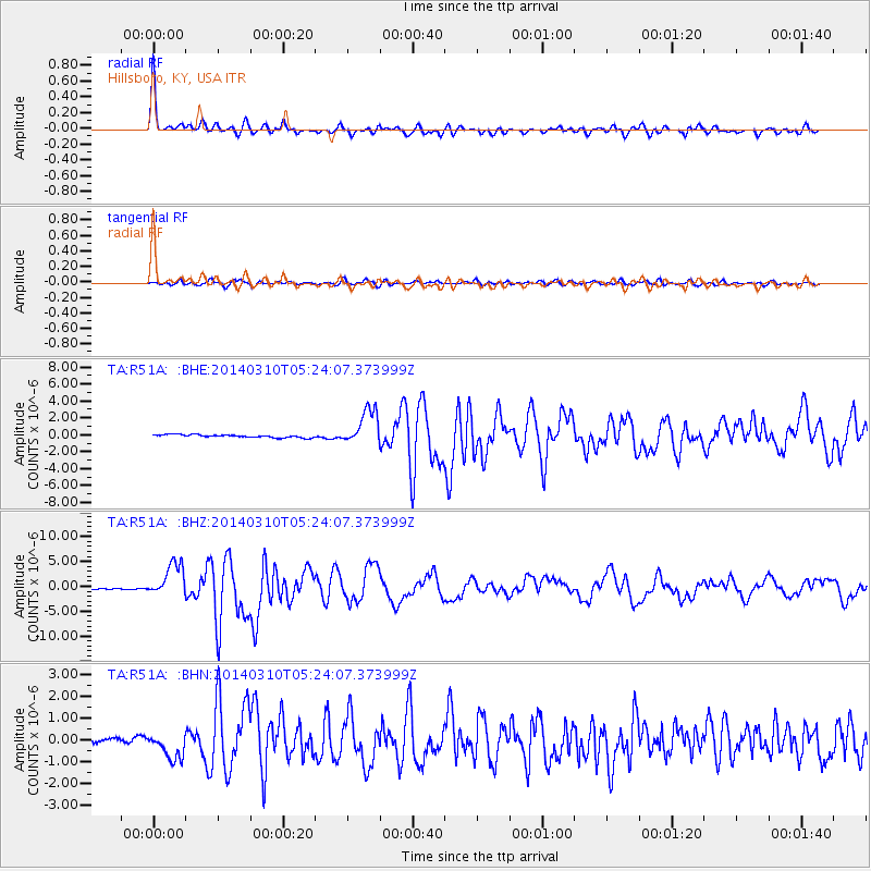
Earthquake location: Off Coast Of Northern California
Earthquake latitude/longitude: 40.8/-125.1
Earthquake time(UTC): 2014/03/10 (069) 05:18:13 GMT
Earthquake Depth: 17 km
Earthquake Magnitude: 6.8 MW, 6.8 MWR, 6.9 MWW, 6.9 MWB, 7.0 MI, 7.0 MWC
Earthquake Catalog/Contributor: NEIC PDE/NEIC COMCAT
Network: TA USArray Transportable Network (new EarthScope stations)
Station: R51A Hillsboro, KY, USA
Lat/Lon: 38.30 N/83.58 W
Elevation: 231 m
Distance: 31.9 deg
Az: 80.762 deg
Baz: 287.833 deg
Ray Param: 0.07885935
Estimated Moho Depth: 44.75 km
Estimated Crust Vp/Vs: 1.99
Assumed Crust Vp: 6.232 km/s
Estimated Crust Vs: 3.139 km/s
Estimated Crust Poisson's Ratio: 0.33
Radial Match: 96.26495 %
Radial Bump: 282
Transverse Match: 87.67312 %
Transverse Bump: 400
SOD ConfigId: 626651
Insert Time: 2014-04-21 03:17:15.983 +0000
GWidth: 2.5
Max Bumps: 400
Tol: 0.001

Signal To Noise

ChannelStoNSTALTA
TA:R51A: :BHZ:20140310T05:24:07.373999Z27.1842563.389099E-61.2467139E-7
TA:R51A: :BHN:20140310T05:24:07.373999Z3.22528465.632828E-71.7464593E-7
TA:R51A: :BHE:20140310T05:24:07.373999Z12.2692422.1047313E-61.7154535E-7
Arrivals
Ps7.6 SECOND
PpPs20 SECOND
PsPs/PpSs28 SECOND