
R56A Bull Pasture Mountain, McDowell, VA, USA - Earthquake Result Viewer
| ||||||||||||||||||
| ||||||||||||||||||
| ||||||||||||||||||
|
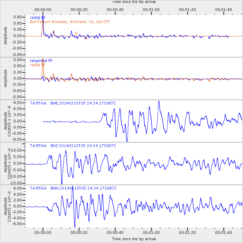
Signal To Noise
| Channel | StoN | STA | LTA |
| TA:R56A: :BHZ:20140310T05:24:34.173987Z | 20.63922 | 3.3017245E-6 | 1.5997333E-7 |
| TA:R56A: :BHN:20140310T05:24:34.173987Z | 4.2368226 | 7.0221114E-7 | 1.6574003E-7 |
| TA:R56A: :BHE:20140310T05:24:34.173987Z | 12.870585 | 2.1041533E-6 | 1.6348542E-7 |
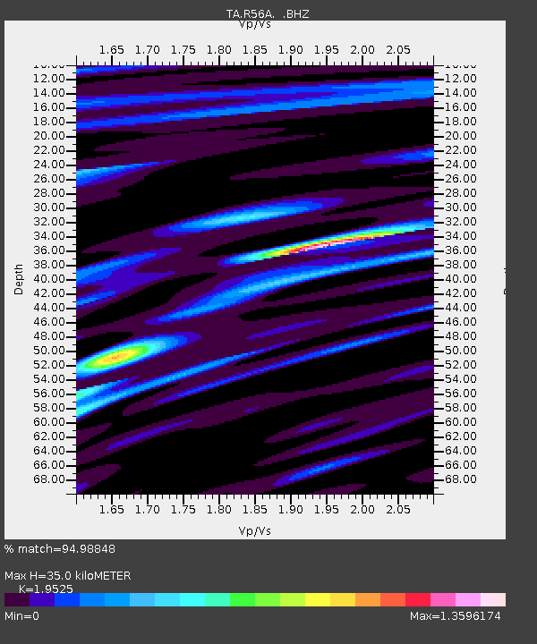
| Arrivals | |
| Ps | 5.8 SECOND |
| PpPs | 16 SECOND |
| PsPs/PpSs | 22 SECOND |

