R60A Leonardtown, MD, USA - Earthquake Result Viewer
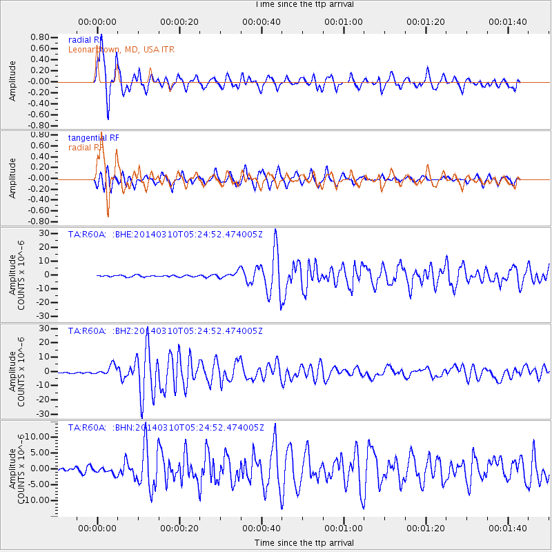
Earthquake location: Off Coast Of Northern California
Earthquake latitude/longitude: 40.8/-125.1
Earthquake time(UTC): 2014/03/10 (069) 05:18:13 GMT
Earthquake Depth: 17 km
Earthquake Magnitude: 6.8 MW, 6.8 MWR, 6.9 MWW, 6.9 MWB, 7.0 MI, 7.0 MWC
Earthquake Catalog/Contributor: NEIC PDE/NEIC COMCAT
Network: TA USArray Transportable Network (new EarthScope stations)
Station: R60A Leonardtown, MD, USA
Lat/Lon: 38.26 N/76.58 W
Elevation: 33 m
Distance: 37.2 deg
Az: 77.702 deg
Baz: 289.633 deg
Ray Param: 0.076276615
Estimated Moho Depth: 13.25 km
Estimated Crust Vp/Vs: 1.60
Assumed Crust Vp: 6.419 km/s
Estimated Crust Vs: 4.006 km/s
Estimated Crust Poisson's Ratio: 0.18
Radial Match: 93.71535 %
Radial Bump: 400
Transverse Match: 79.729546 %
Transverse Bump: 400
SOD ConfigId: 626651
Insert Time: 2014-04-21 03:17:39.835 +0000
GWidth: 2.5
Max Bumps: 400
Tol: 0.001

Signal To Noise

ChannelStoNSTALTA
TA:R60A: :BHZ:20140310T05:24:52.474005Z11.1521853.7045138E-63.3217827E-7
TA:R60A: :BHN:20140310T05:24:52.474005Z1.09291741.1138383E-61.0191422E-6
TA:R60A: :BHE:20140310T05:24:52.474005Z4.56268642.5226816E-65.5289394E-7
Arrivals
Ps1.3 SECOND
PpPs4.9 SECOND
PsPs/PpSs6.3 SECOND