
S49A Springfield, KY, USA - Earthquake Result Viewer
| ||||||||||||||||||
| ||||||||||||||||||
| ||||||||||||||||||
|
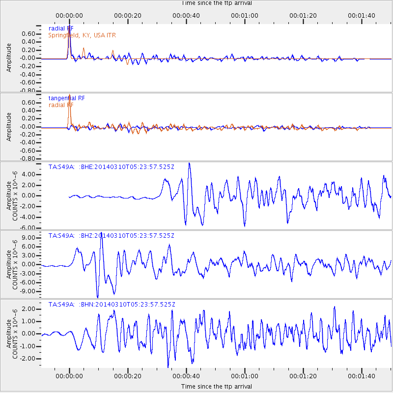
Signal To Noise
| Channel | StoN | STA | LTA |
| TA:S49A: :BHZ:20140310T05:23:57.525Z | 19.637436 | 3.2116754E-6 | 1.6354862E-7 |
| TA:S49A: :BHN:20140310T05:23:57.525Z | 4.034423 | 7.0210143E-7 | 1.7402772E-7 |
| TA:S49A: :BHE:20140310T05:23:57.525Z | 11.063444 | 1.9155364E-6 | 1.7314106E-7 |
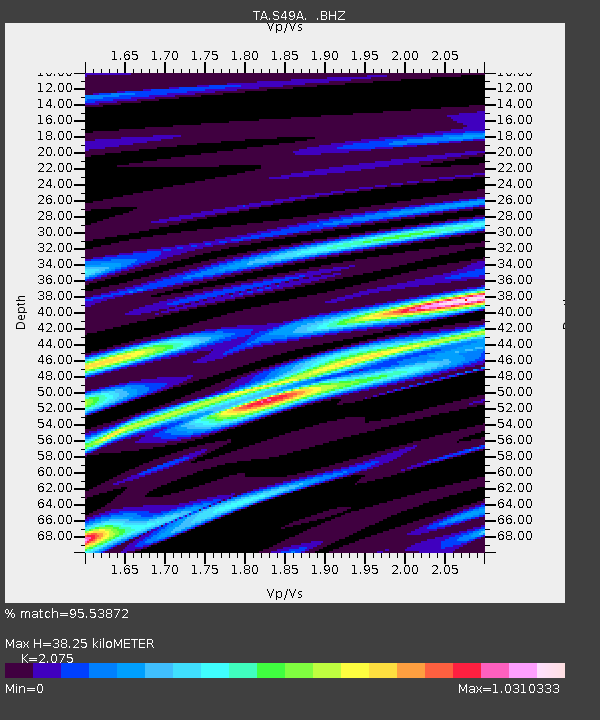
| Arrivals | |
| Ps | 6.8 SECOND |
| PpPs | 17 SECOND |
| PsPs/PpSs | 24 SECOND |

