
S51A Beattyville, KY, USA - Earthquake Result Viewer
| ||||||||||||||||||
| ||||||||||||||||||
| ||||||||||||||||||
|
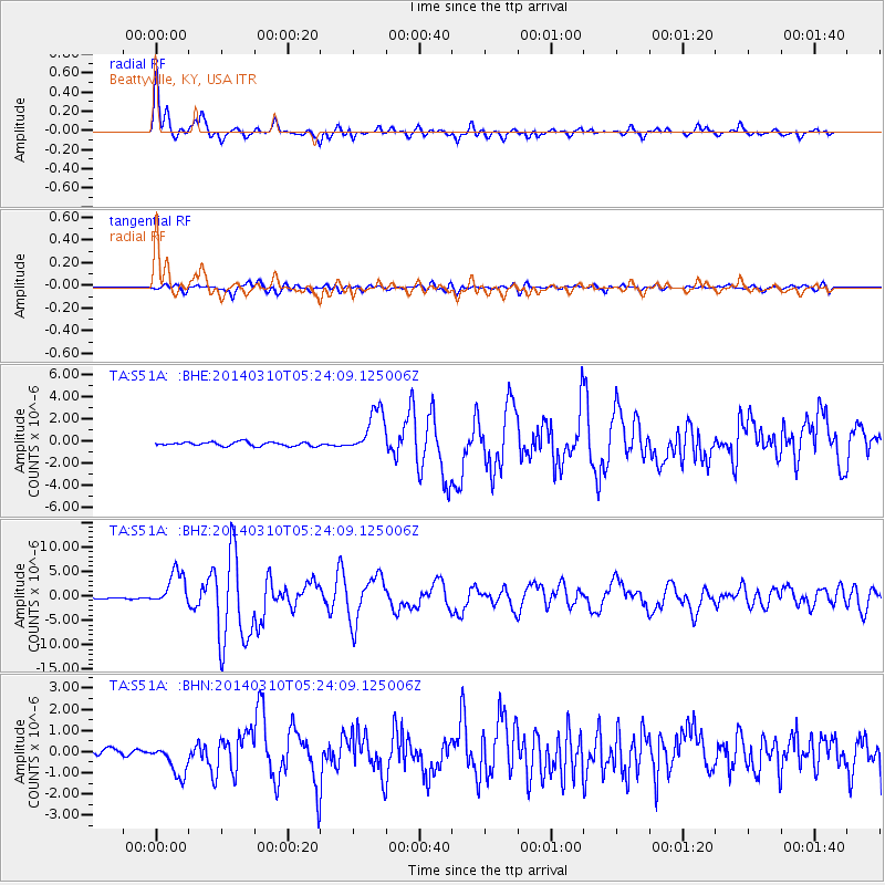
Signal To Noise
| Channel | StoN | STA | LTA |
| TA:S51A: :BHZ:20140310T05:24:09.125006Z | 22.793869 | 3.520994E-6 | 1.544711E-7 |
| TA:S51A: :BHN:20140310T05:24:09.125006Z | 6.6659174 | 7.7660013E-7 | 1.1650311E-7 |
| TA:S51A: :BHE:20140310T05:24:09.125006Z | 11.652702 | 2.0300893E-6 | 1.7421617E-7 |
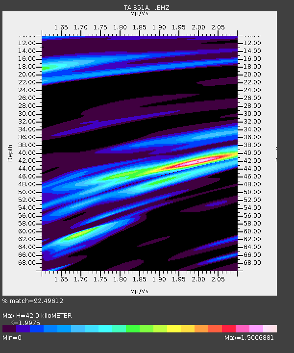
| Arrivals | |
| Ps | 6.9 SECOND |
| PpPs | 18 SECOND |
| PsPs/PpSs | 25 SECOND |

