
S52A Salyersville, KY, USA - Earthquake Result Viewer
| ||||||||||||||||||
| ||||||||||||||||||
| ||||||||||||||||||
|
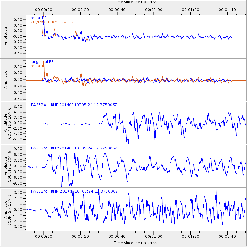
Signal To Noise
| Channel | StoN | STA | LTA |
| TA:S52A: :BHZ:20140310T05:24:12.375006Z | 14.0609665 | 3.6353285E-6 | 2.5854047E-7 |
| TA:S52A: :BHN:20140310T05:24:12.375006Z | 4.4387765 | 7.452718E-7 | 1.6790027E-7 |
| TA:S52A: :BHE:20140310T05:24:12.375006Z | 16.018824 | 1.9699542E-6 | 1.2297745E-7 |
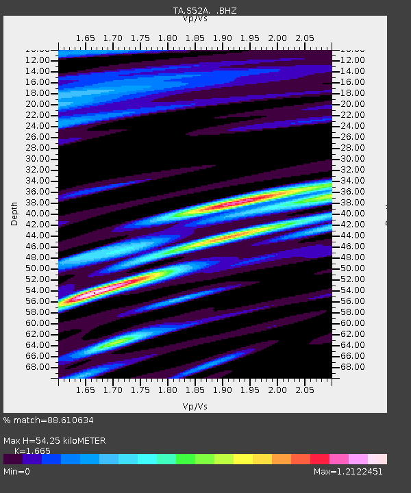
| Arrivals | |
| Ps | 6.1 SECOND |
| PpPs | 20 SECOND |
| PsPs/PpSs | 27 SECOND |

