S55A Lewisburg, WV, USA - Earthquake Result Viewer
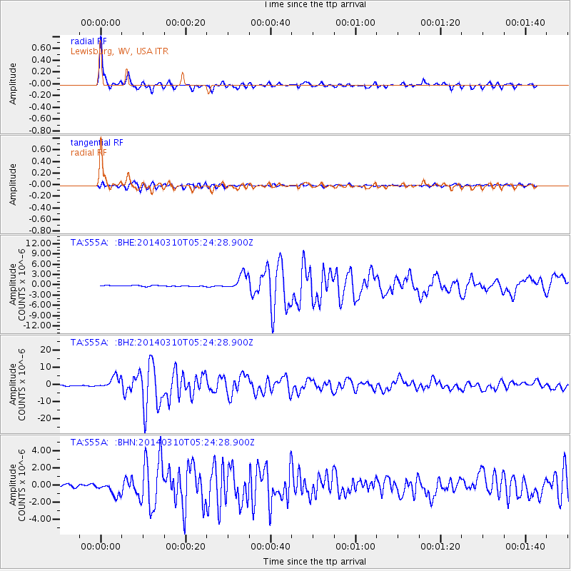
Earthquake location: Off Coast Of Northern California
Earthquake latitude/longitude: 40.8/-125.1
Earthquake time(UTC): 2014/03/10 (069) 05:18:13 GMT
Earthquake Depth: 17 km
Earthquake Magnitude: 6.8 MW, 6.8 MWR, 6.9 MWW, 6.9 MWB, 7.0 MI, 7.0 MWC
Earthquake Catalog/Contributor: NEIC PDE/NEIC COMCAT
Network: TA USArray Transportable Network (new EarthScope stations)
Station: S55A Lewisburg, WV, USA
Lat/Lon: 37.77 N/80.50 W
Elevation: 647 m
Distance: 34.4 deg
Az: 80.258 deg
Baz: 289.302 deg
Ray Param: 0.07774898
Estimated Moho Depth: 34.0 km
Estimated Crust Vp/Vs: 2.10
Assumed Crust Vp: 6.159 km/s
Estimated Crust Vs: 2.94 km/s
Estimated Crust Poisson's Ratio: 0.35
Radial Match: 96.35464 %
Radial Bump: 347
Transverse Match: 88.58118 %
Transverse Bump: 400
SOD ConfigId: 626651
Insert Time: 2014-04-21 03:17:58.595 +0000
GWidth: 2.5
Max Bumps: 400
Tol: 0.001

Signal To Noise

ChannelStoNSTALTA
TA:S55A: :BHZ:20140310T05:24:28.900Z13.0610093.6772506E-62.8154412E-7
TA:S55A: :BHN:20140310T05:24:28.900Z6.23248538.091948E-71.2983502E-7
TA:S55A: :BHE:20140310T05:24:28.900Z18.1758562.399341E-61.3200705E-7
Arrivals
Ps6.4 SECOND
PpPs16 SECOND
PsPs/PpSs23 SECOND