You are here: Home > Network List > TA - USArray Transportable Network (new EarthScope stations) Stations List
> Station R11A Troy Canyon, Currant, NV, USA > Earthquake Result Viewer
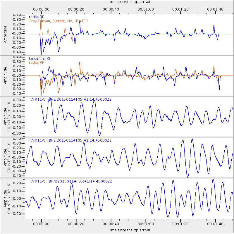
R11A Troy Canyon, Currant, NV, USA - Earthquake Result Viewer
*The percent match for this event was below the threshold and hence no stack was calculated.
| Earthquake location: |
Tonga Islands Region |
| Earthquake latitude/longitude: |
-22.1/-175.6 |
| Earthquake time(UTC): |
2015/01/14 (014) 05:29:34 GMT |
| Earthquake Depth: |
100 km |
| Earthquake Magnitude: |
5.1 MW, 4.7 mb |
| Earthquake Catalog/Contributor: |
ISC/ISC |
|
| Network: |
TA USArray Transportable Network (new EarthScope stations) |
| Station: |
R11A Troy Canyon, Currant, NV, USA |
| Lat/Lon: |
38.35 N/115.59 W |
| Elevation: |
1756 m |
|
| Distance: |
82.3 deg |
| Az: |
43.391 deg |
| Baz: |
234.103 deg |
| Ray Param: |
$rayparam |
*The percent match for this event was below the threshold and hence was not used in the summary stack. |
|
| Radial Match: |
55.4095 % |
| Radial Bump: |
400 |
| Transverse Match: |
52.771984 % |
| Transverse Bump: |
400 |
| SOD ConfigId: |
3390531 |
| Insert Time: |
2019-04-16 01:20:38.113 +0000 |
| GWidth: |
2.5 |
| Max Bumps: |
400 |
| Tol: |
0.001 |
|
Signal To Noise
| Channel | StoN | STA | LTA |
| TA:R11A: :BHZ:20150114T05:41:14.450002Z | 0.7131023 | 9.498196E-8 | 1.3319541E-7 |
| TA:R11A: :BHN:20150114T05:41:14.450002Z | 0.3955988 | 3.8434013E-8 | 9.715402E-8 |
| TA:R11A: :BHE:20150114T05:41:14.450002Z | 1.6420697 | 2.4306902E-7 | 1.48026E-7 |
| Arrivals |
| Ps | |
| PpPs | |
| PsPs/PpSs | |


