T53A Wise, VA, USA - Earthquake Result Viewer
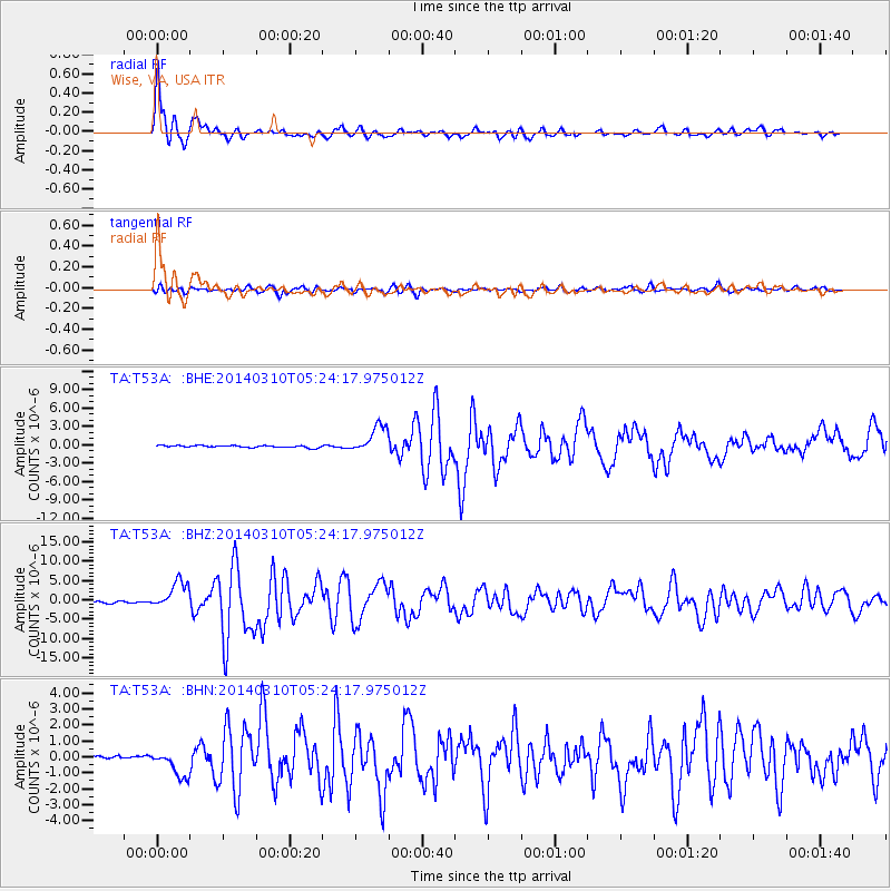
Earthquake location: Off Coast Of Northern California
Earthquake latitude/longitude: 40.8/-125.1
Earthquake time(UTC): 2014/03/10 (069) 05:18:13 GMT
Earthquake Depth: 17 km
Earthquake Magnitude: 6.8 MW, 6.8 MWR, 6.9 MWW, 6.9 MWB, 7.0 MI, 7.0 MWC
Earthquake Catalog/Contributor: NEIC PDE/NEIC COMCAT
Network: TA USArray Transportable Network (new EarthScope stations)
Station: T53A Wise, VA, USA
Lat/Lon: 36.98 N/82.54 W
Elevation: 818 m
Distance: 33.1 deg
Az: 82.575 deg
Baz: 289.999 deg
Ray Param: 0.078333996
Estimated Moho Depth: 22.75 km
Estimated Crust Vp/Vs: 1.70
Assumed Crust Vp: 6.476 km/s
Estimated Crust Vs: 3.821 km/s
Estimated Crust Poisson's Ratio: 0.23
Radial Match: 94.37509 %
Radial Bump: 400
Transverse Match: 80.84986 %
Transverse Bump: 400
SOD ConfigId: 626651
Insert Time: 2014-04-21 03:18:26.041 +0000
GWidth: 2.5
Max Bumps: 400
Tol: 0.001

Signal To Noise

ChannelStoNSTALTA
TA:T53A: :BHZ:20140310T05:24:17.975012Z16.7587173.5289897E-62.1057636E-7
TA:T53A: :BHN:20140310T05:24:17.975012Z6.0262078.294829E-71.3764594E-7
TA:T53A: :BHE:20140310T05:24:17.975012Z13.2081492.2507863E-61.7040891E-7
Arrivals
Ps2.7 SECOND
PpPs8.7 SECOND
PsPs/PpSs11 SECOND