T54A Tazewell, VA, USA - Earthquake Result Viewer
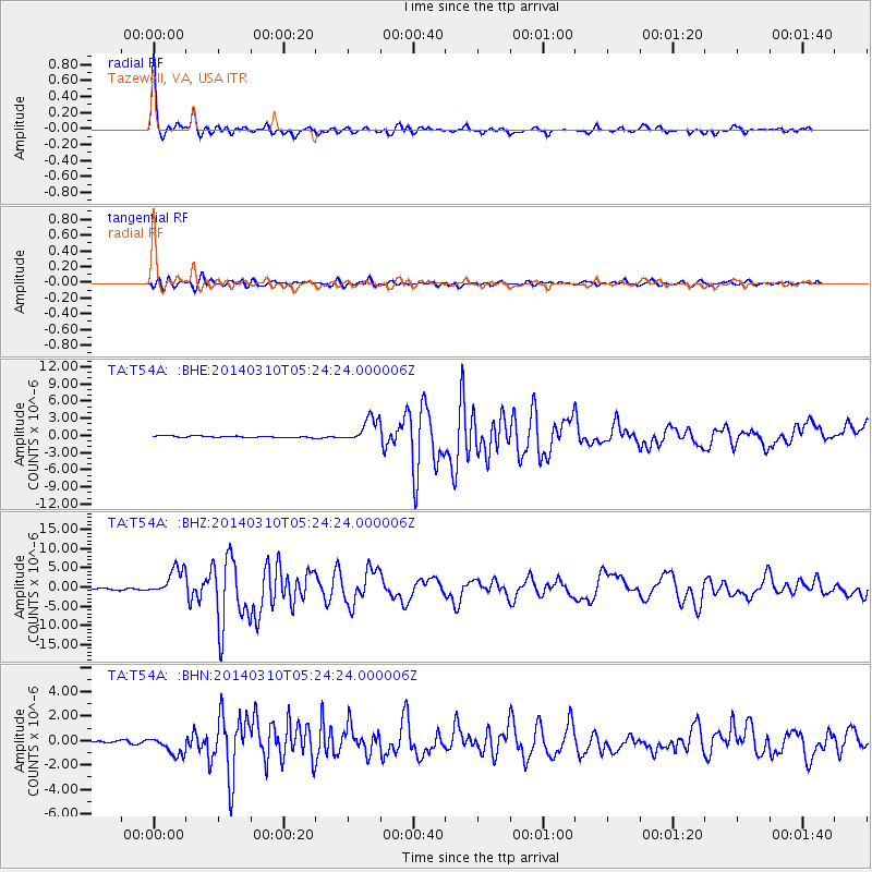
Earthquake location: Off Coast Of Northern California
Earthquake latitude/longitude: 40.8/-125.1
Earthquake time(UTC): 2014/03/10 (069) 05:18:13 GMT
Earthquake Depth: 17 km
Earthquake Magnitude: 6.8 MW, 6.8 MWR, 6.9 MWW, 6.9 MWB, 7.0 MI, 7.0 MWC
Earthquake Catalog/Contributor: NEIC PDE/NEIC COMCAT
Network: TA USArray Transportable Network (new EarthScope stations)
Station: T54A Tazewell, VA, USA
Lat/Lon: 37.06 N/81.58 W
Elevation: 852 m
Distance: 33.8 deg
Az: 81.965 deg
Baz: 290.065 deg
Ray Param: 0.07801444
Estimated Moho Depth: 34.75 km
Estimated Crust Vp/Vs: 2.02
Assumed Crust Vp: 6.159 km/s
Estimated Crust Vs: 3.049 km/s
Estimated Crust Poisson's Ratio: 0.34
Radial Match: 96.51599 %
Radial Bump: 284
Transverse Match: 86.71511 %
Transverse Bump: 400
SOD ConfigId: 626651
Insert Time: 2014-04-21 03:18:26.908 +0000
GWidth: 2.5
Max Bumps: 400
Tol: 0.001

Signal To Noise

ChannelStoNSTALTA
TA:T54A: :BHZ:20140310T05:24:24.000006Z18.5308593.5778519E-61.9307534E-7
TA:T54A: :BHN:20140310T05:24:24.000006Z5.218577.890208E-71.5119483E-7
TA:T54A: :BHE:20140310T05:24:24.000006Z15.859442.179036E-61.3739678E-7
Arrivals
Ps6.1 SECOND
PpPs16 SECOND
PsPs/PpSs22 SECOND