
T56A Rocky Mt, VA, USA - Earthquake Result Viewer
| ||||||||||||||||||
| ||||||||||||||||||
| ||||||||||||||||||
|
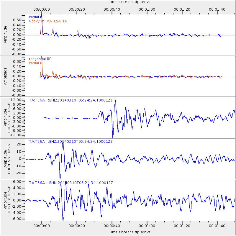
Signal To Noise
| Channel | StoN | STA | LTA |
| TA:T56A: :BHZ:20140310T05:24:34.100012Z | 17.642601 | 3.8492713E-6 | 2.181805E-7 |
| TA:T56A: :BHN:20140310T05:24:34.100012Z | 6.6056857 | 8.9284555E-7 | 1.3516318E-7 |
| TA:T56A: :BHE:20140310T05:24:34.100012Z | 14.352679 | 2.133566E-6 | 1.486528E-7 |
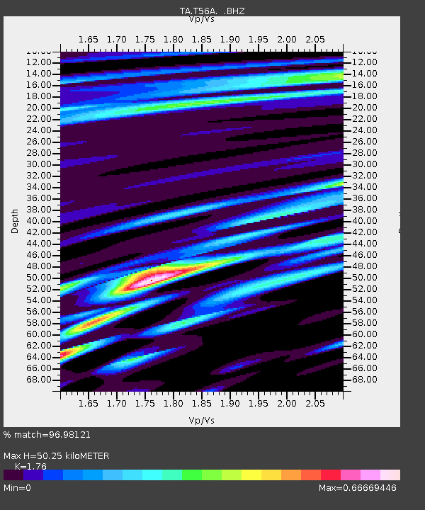
| Arrivals | |
| Ps | 6.7 SECOND |
| PpPs | 21 SECOND |
| PsPs/PpSs | 28 SECOND |

